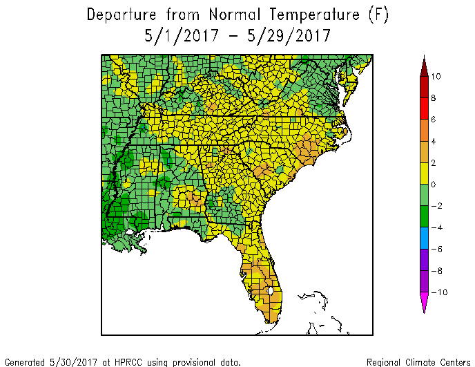
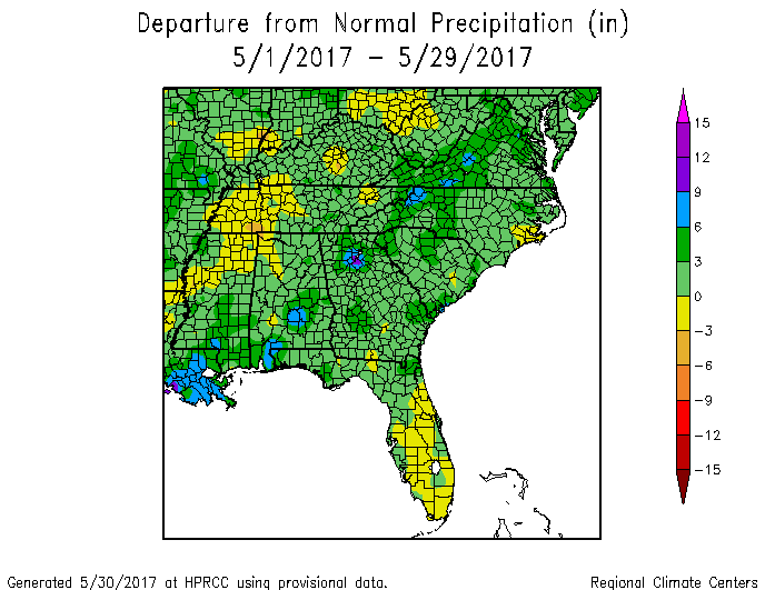
Here is a quick look at the climate statistics for May now that it is almost over. With two days to go, the maps from the High Plains Regional Climate Center show that most of the Southeast was slightly above normal in temperature, with the largest departures from normal in southern Florida where the drought has been expanding and southeast North Carolina. Most of the Southeast was also wetter than normal with the exception of the dry area in the Florida peninsula. The wettest areas have been in southeast Alabama, northern Georgia and western NC and Virginia.