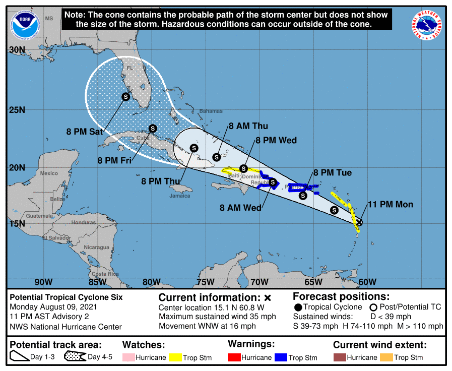
As of 11 pm tonight, Potential Tropical Storm 6 (soon to be known as Fred) is moving west into the Caribbean and then NW towards the Florida peninsula. Of course, since it is not even a named storm yet, there is a lot of uncertainty about where this storm will go and how strong it will be, but most of the models predict it will likely remain a tropical storm due to entrainment of Saharan dry air and some other confounding factors like potential interaction with the mountainous islands. By the time you read this on Tuesday morning, it may already be named.
Folks in Florida should keep an eye on deteriorating conditions on Thursday and Friday, and those in southern Georgia and the Carolinas (and potentially Alabama) should pay attention over the weekend, especially if you have plans near the Gulf Coast. Now is the time to walk your property and assess any potential hazards that need to be taken care of before the stronger winds arrive.