The content on this page is retained only for recordkeeping, historical reference, or research. These materials are preserved in their original form and may not meet current WCAG 2.1 AA accessibility standards.
These archived materials are not required to be remediated. However, we remain committed to equitable access. If you need an accessible version of any archived item to participate in our current programs and services, we will provide one when feasible upon request at caesweb@uga.edu.
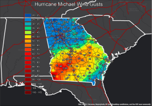
The National Weather Service office in Peachtree City, GA has posted a summary of Hurricane Michael’s impacts on Georgia, including maps of wind speed, rainfall totals, photos, and maps of tornado paths associated with the storm. You can view it here.