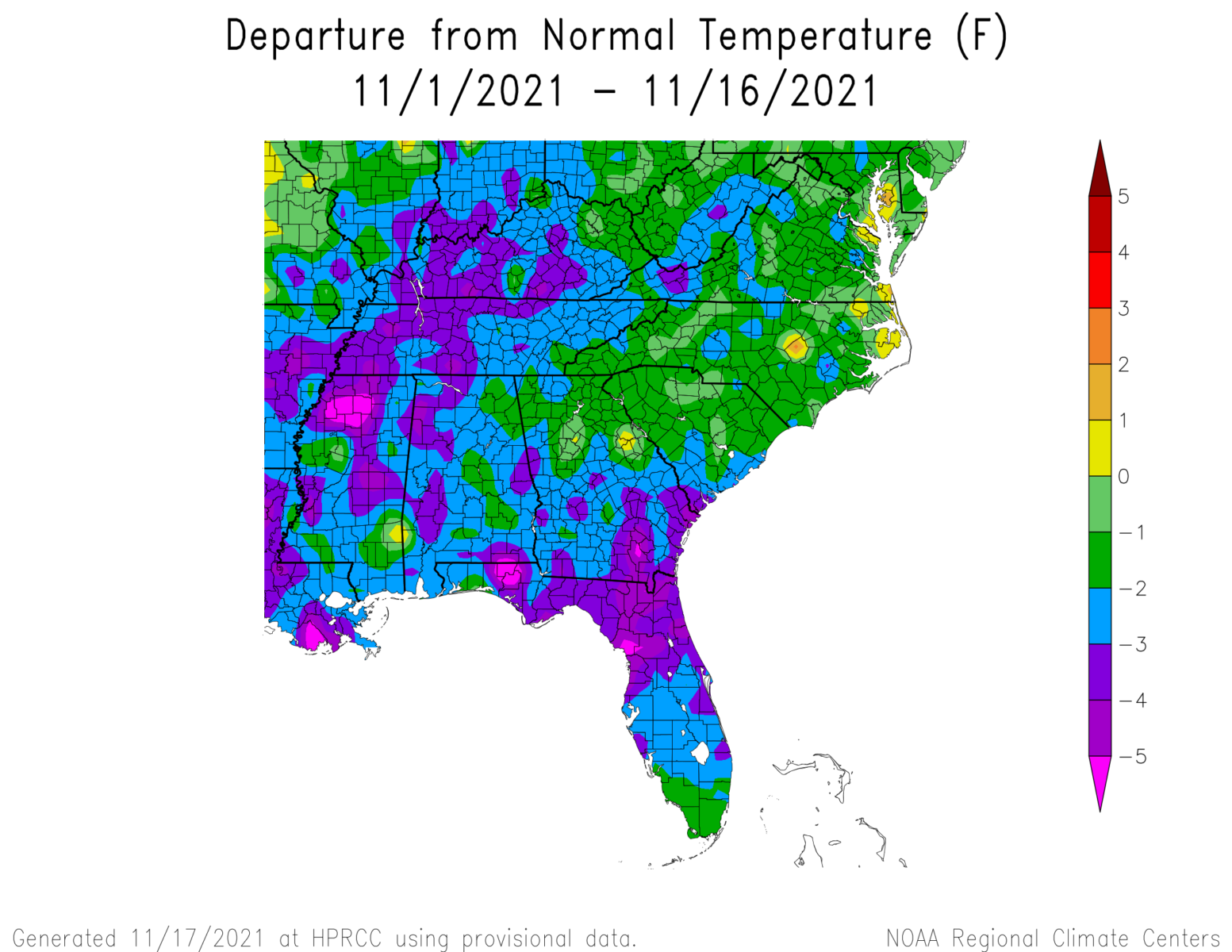
We are about halfway through the month of November, so let’s take a look at where we are. The temperature departure map shows that nearly all of the Southeast was cooler than normal, and in some places as much as 5 degrees lower than normal, especially where it was wet. Precipitation was hit or miss, with most of the region receiving only a small percent of normal. The only exceptions were the Florida peninsula and the southeast coastal area of Georgia and, to a lesser extent, South Carolina. That was associated with a wet system that moved over that area earlier in the month, but most of the rest of the month has been dry. So far, the end of November is continuing to look cooler and drier than normal with the likely passage of at least one and probably two cold fronts in the next week.