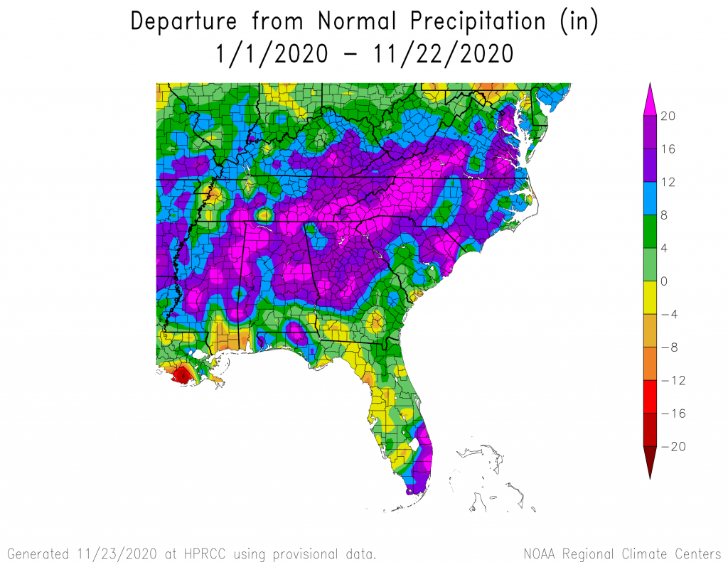
The maps from the High Plains Regional Climate Center show that so far this November, temperatures are running above normal again for the entire Southeast. Precipitation is wetter than normal along the East Coast but is drier than normal in Alabama and parts of Georgia. For the year to date, nearly all of the region is wetter than normal as well as warmer than normal. If you use the Southeast Regional Climate Center’s Perspectives tool at https://sercc.com/perspectives, you will see that this year so far is the warmest on record for most of Florida and eastern NC and VA and is in the top five warmest elsewhere. Areas north of the Fall Line stretching from Alabama to Virginia are mainly in the top five wettest years on record for the year so far. The southeast coast of Florida has also been extremely wet due to the impacts of some of the tropical storms this year.