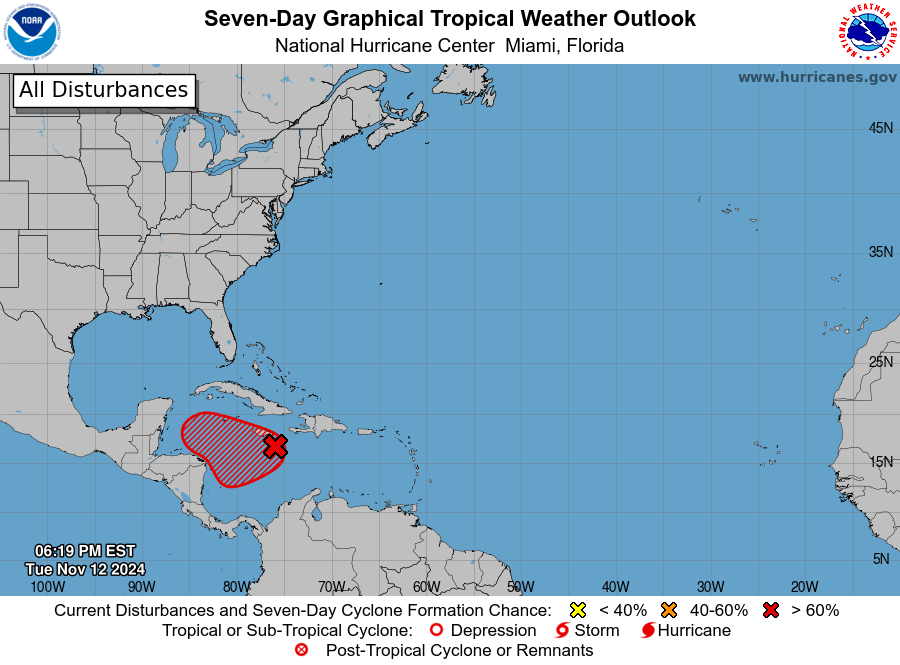
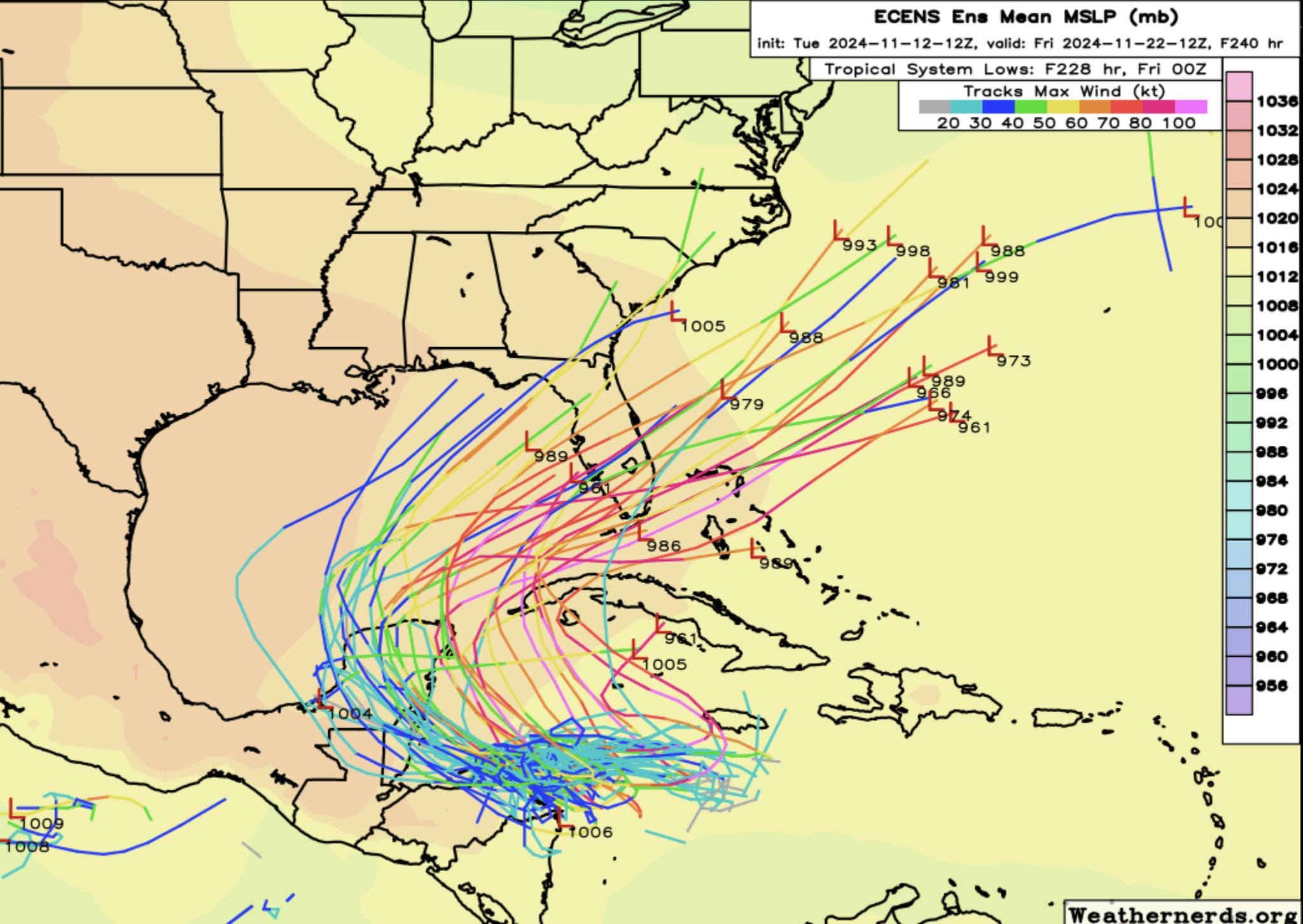
The Atlantic tropical season is not over just yet. The National Hurricane Center has identified another area with a 90% chance of development in the next week in the western Caribbean Sea where tropical cyclones typically develop in late fall. If it develops as expected, it would be called Sara. The storm is expected to drift north into the Gulf, then will sit over the Gulf for a few days before likely being picked up by a trough of low pressure and drawn out to the east or northeast. This won’t happen quickly but there is still some very warm water in the Gulf that could help the storm to intensify quickly as Rafael did. Many of the model tracks indicate that the storm could move over Florida or even southeast Georgia, although we don’t know exactly how strong it would be. It would likely be approaching Florida by around November 20, although this is subject to change since the storm has not yet developed. At this point in time it is mostly something to watch but if you live in the area most likely to get hit, you will want to monitor it carefully if you are doing farm activities that are likely to be affected by rain or wind.