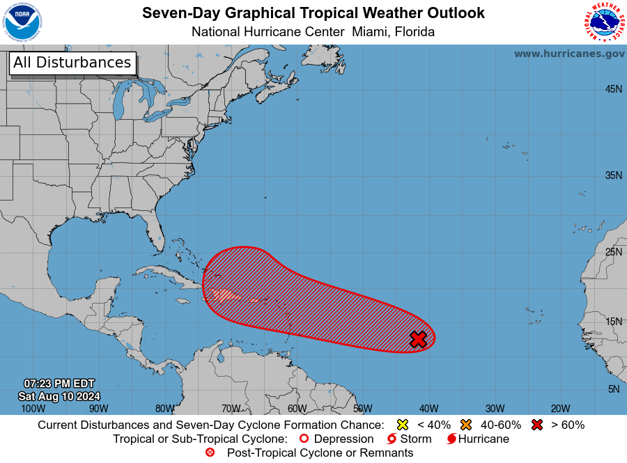
The latest tropical disturbance, for now named Investigation 98, has a 50% chance of developing into a named storm (Ernesto) in two days and 90% chance in seven days. The current model paths for the storm are quite consistent in showing that the storm is likely to turn north before it gets to the East Coast and so will miss the Southeast mainland. But many of the tracks put it near or over Puerto Rico, so anyone who is in the Virgin Islands or Puerto Rico should be watching this storm carefully for updates to the predicted path. Once the storm becomes an organized named storm there should be more clarity about exactly where it will go.