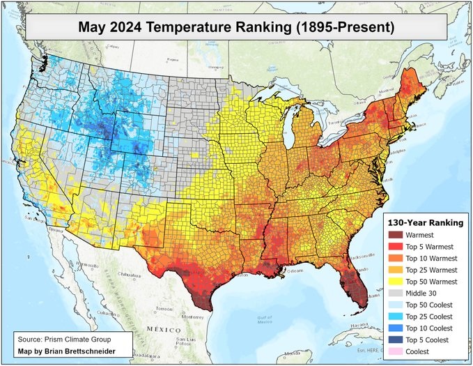
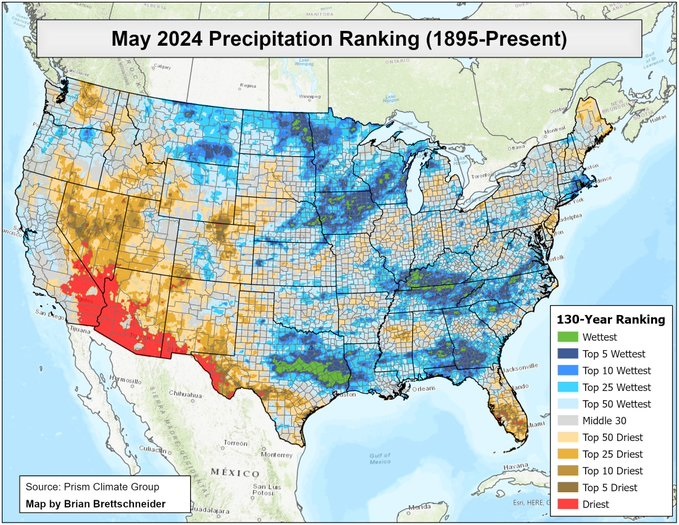
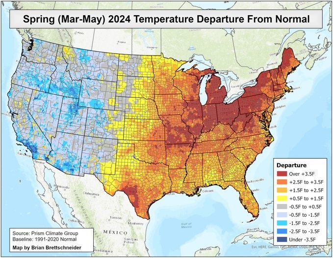
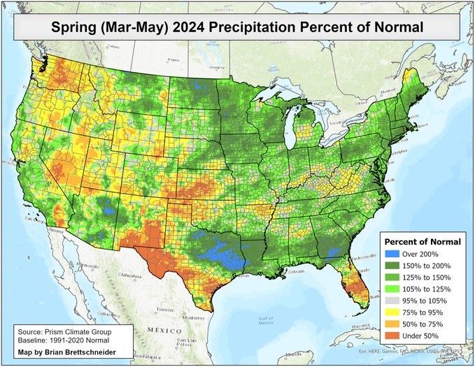
Brian Brettschneider, @Climatologist49 on Twitter, is one of the first climatologists to provide climate summary maps for the US after the end of each month and season. Here are the maps he produced for May and the March-May periods. They show that May was warmer than normal everywhere but it was especially hot in Florida in May and in Virginia and North Carolina in spring as a whole. May and March-May were very wet in southern AL and GA and the Carolinas but were extremely dry in the Florida Peninsula, which contributed to the developing drought there.