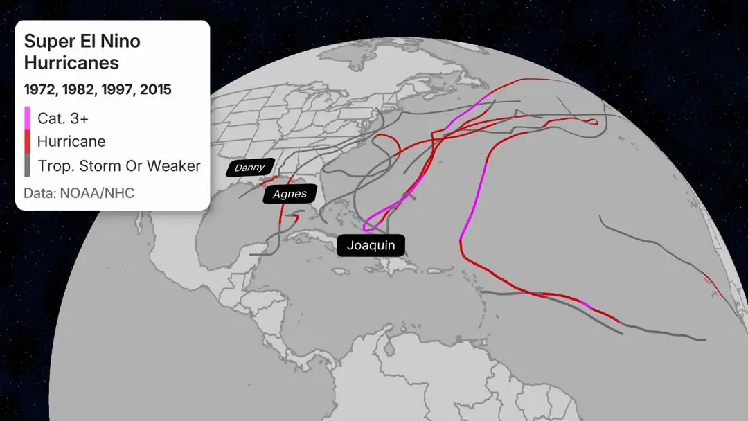
Hurricane seasonal forecasts usually provide an estimate of the number of storms that you can expect in a given season. This year, with an El Nino expected to develop rapidly over the next few months, could be a rare year when the El Nino warming in the Eastern Pacific Ocean is especially strong, leading to what media calls a “Super El Nino”. However, the forecasts generally only give the number of storms, not where they will go. I thought this Weather Channel discussion of past tropical storms that occurred in previous “super El Nino” years was useful for seeing where the storms in those years traveled and how strong they were. Unfortunately for us in the Southeast, it shows that most of the storms in those years stayed off the East Coast, recurving without making landfall, which is similar to what happened in 2025. The few storms that came over the Southeast were mainly storms that originated in the Gulf. This means that drought relief from the tropics this year may not be very likely. We will be watching the tropics closely over the next few months because it only takes one storm coming over the right area to provide either beneficial rains or damaging winds. We don’t know yet which it will be or if we will get bypassed again this year.