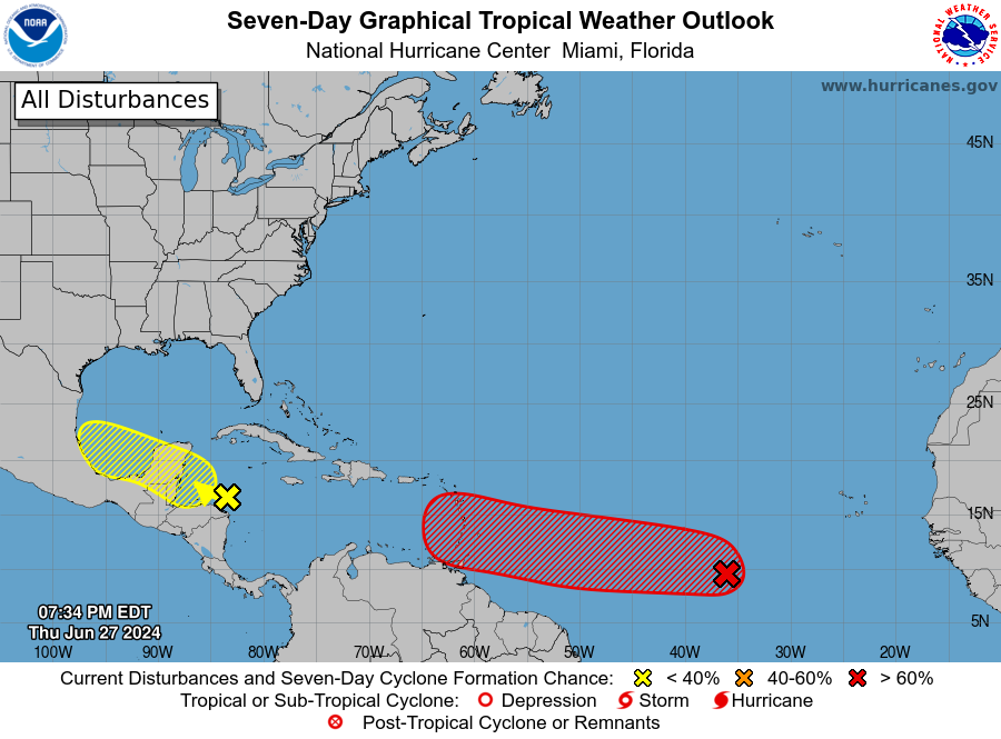
The tropics have really picked up in activity in the past few days. The big system to watch right now is in the eastern Atlantic, moving WNW towards the Caribbean. This area of interest has a 90% chance of becoming a named storm in the next week. The model tracks show a very wide spread of where the storm could go, but not many of them come to the Southeast and so I am not particularly concerned about it at this point. We have plenty of time to watch it before it is of concern, if at all. I think most likely it will stay south of Cuba and move into the western Gulf, where it could bring more heavy rain to Mexico and South Texas. A storm like this is pretty rare for June, since usually June storms form closer to the US and not in the Main Development Region west of Africa. You can expect to see a lot more of them in the next few months as the tropics really get cranked up.