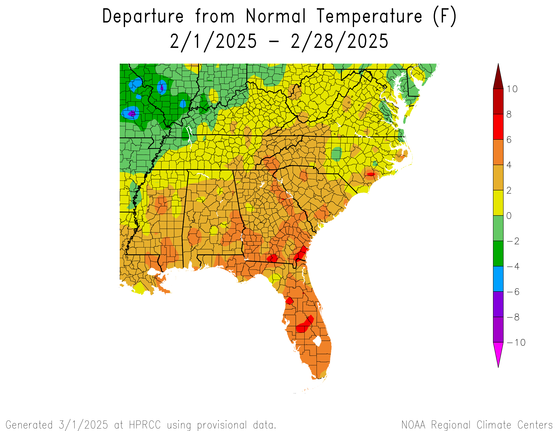
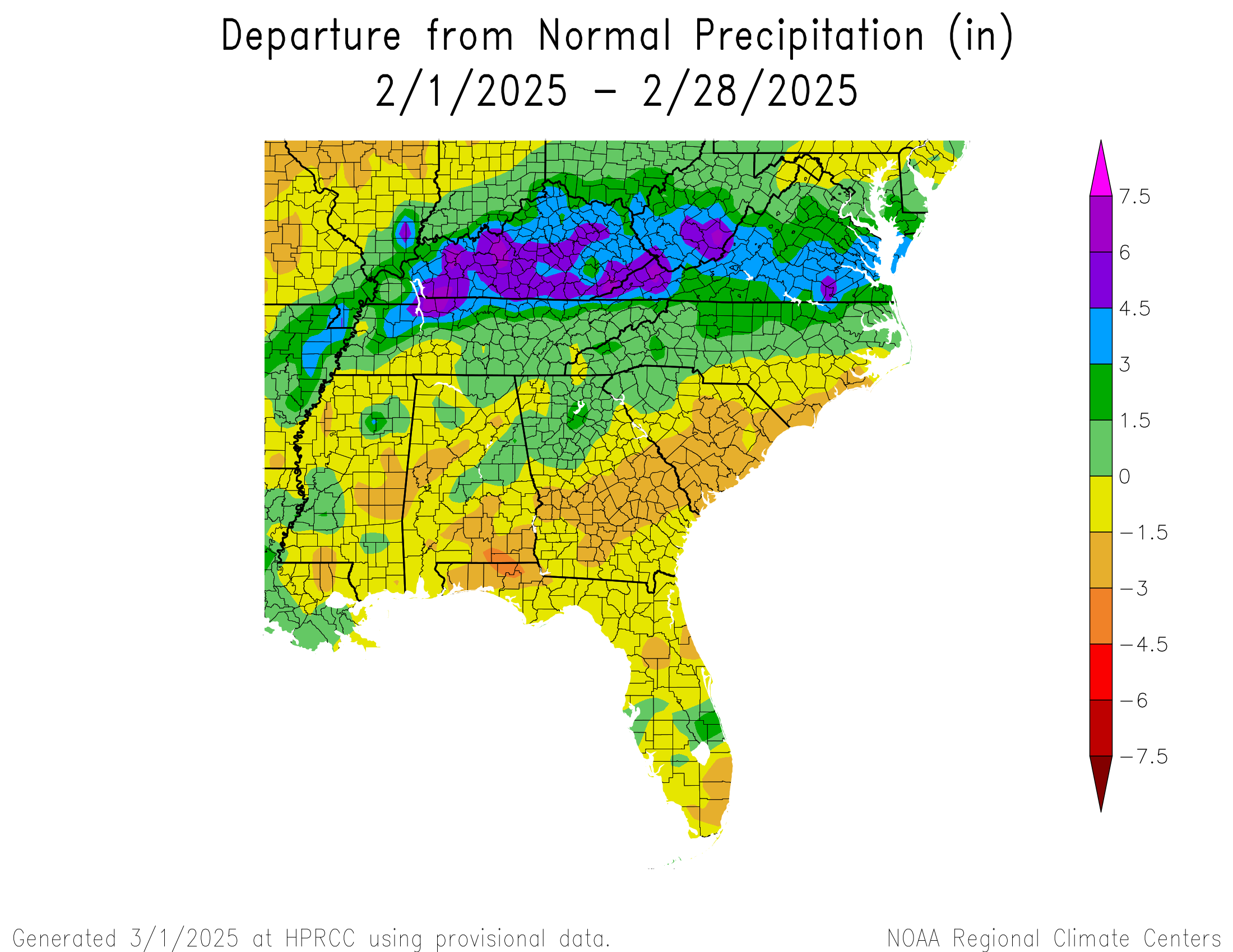
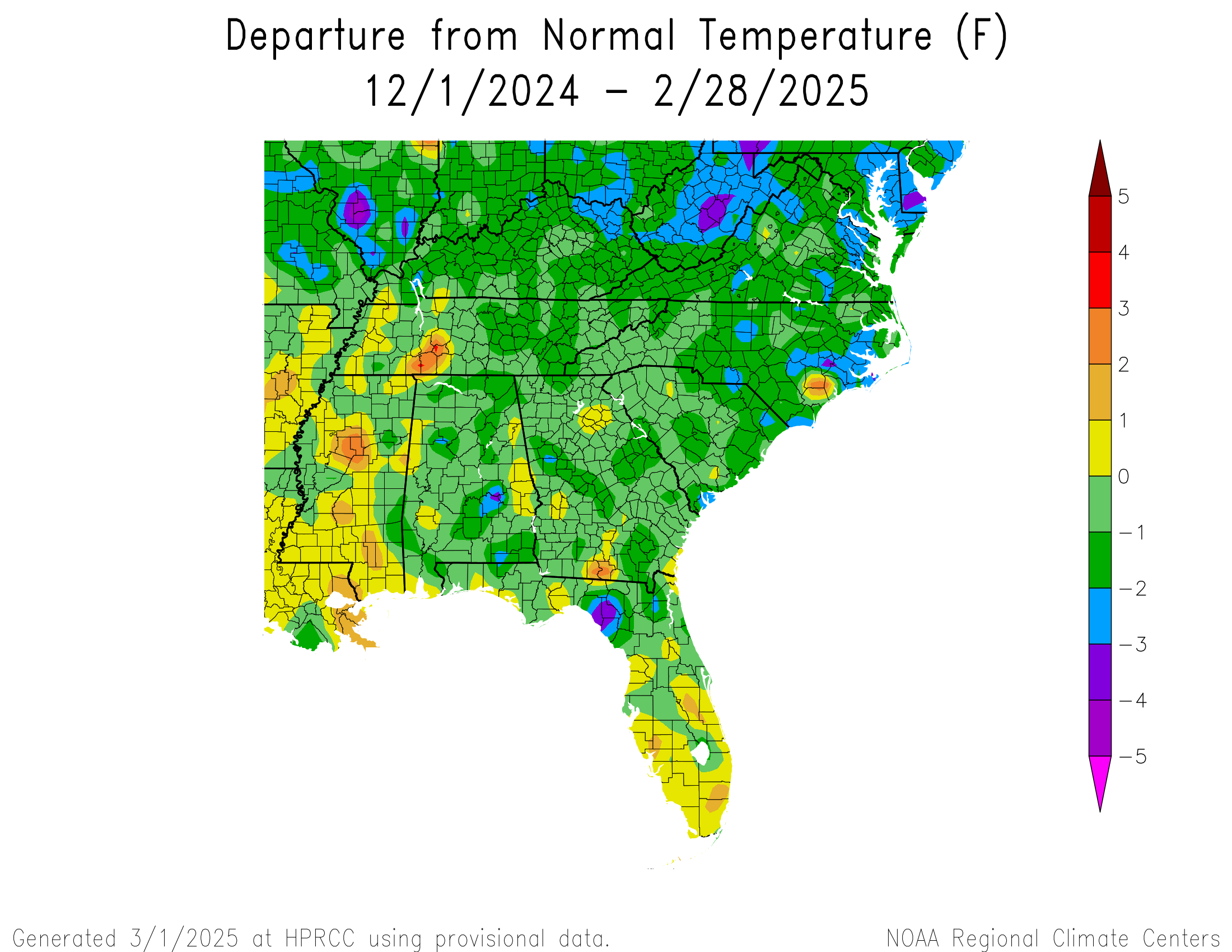
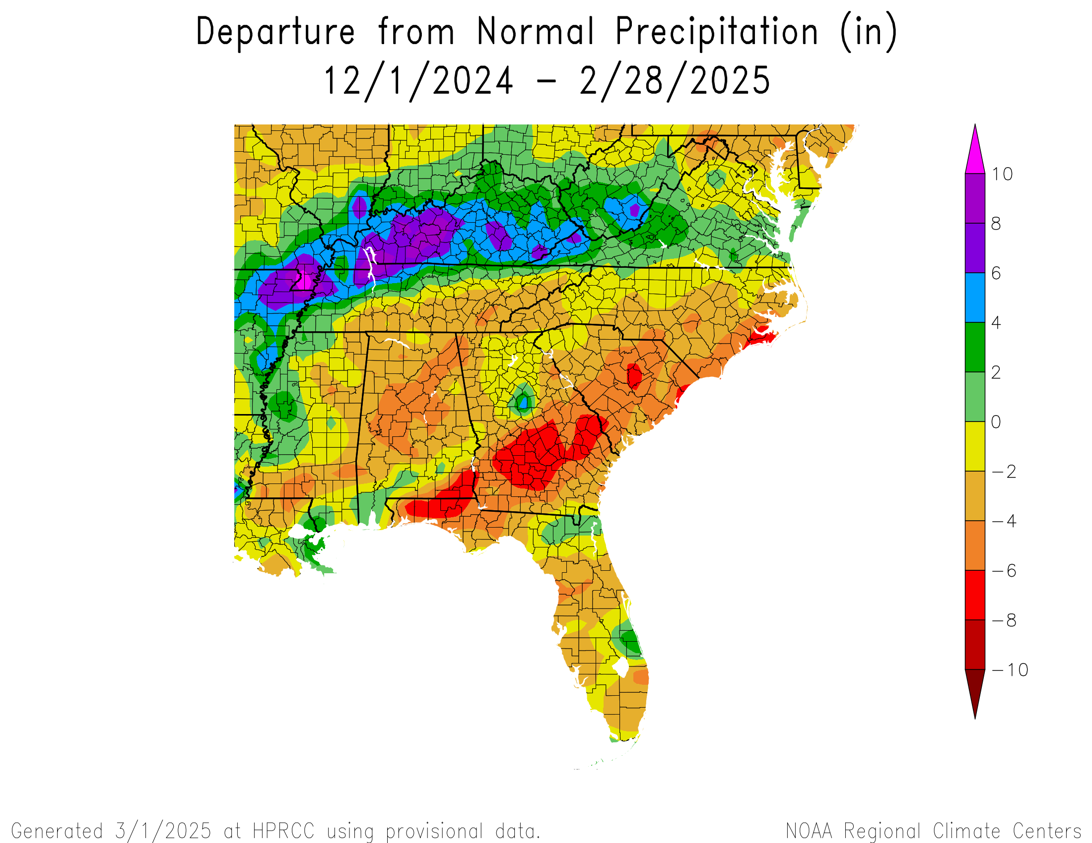
The preliminary maps of temperature and precipitation for February 2025 show that the region as a whole showed a pattern that is consistent with the current La Nina that is occurring in the Eastern Pacific Ocean. Warmer and drier conditions covered most of the southern parts of the region this month, while wetter than normal conditions were present in northern parts of the region, which is expected when we are in a weak La Nina as we are this year. The precipitation pattern was even stronger when you look at the winter season as a whole, but the temperature departure for the December through February period were cooler than normal due to the intrusion of cold polar air into the region, especially in January. The drier than normal winter means that soil moisture deficits are present and will become worse once plants leave winter dormancy and spring growth begins as plants start taking water up through their roots at a higher rate. This could lead to an increase of drought in southern AL and GA and in Florida in the coming weeks as the growing season begins.