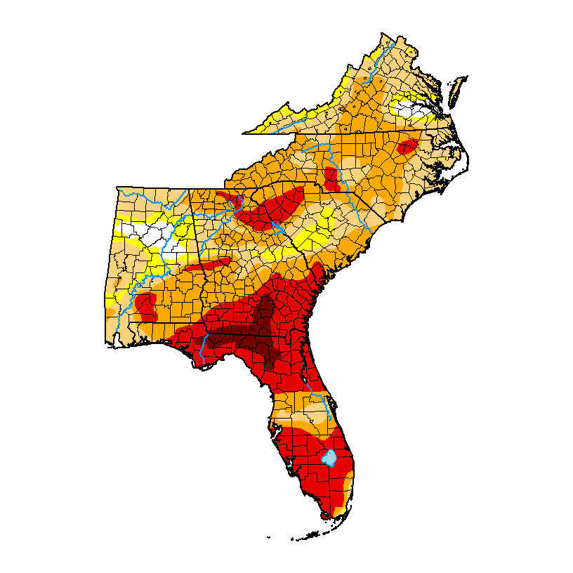
The most recent Drought Monitor, released late last week, showed an increase in drought conditions across most of the region, although a few small areas that got rain did see some improvement. The biggest increase was in exceptional drought in southern Georgia and northern Florida with some smaller areas of growing drought in the Carolinas. We did note that the small area of abnormally dry (D0) conditions in Puerto Rico is finally gone, leaving them free of any dry conditions. Since little rain has fallen in the past week, I expect the next Drought Monitor that will be released on Thursday based on rainfall amounts through Tuesday to show conditions that might be even worse than this map. Fortunately, a change in the weather pattern does show an increased chance of rain starting on Tuesday and increasing later this week and through the weekend. Will it rain out the Easter sunrise services this weekend? Too early to tell but if you are planning an outdoor service you will want to watch the forecasts.