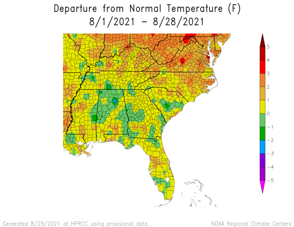
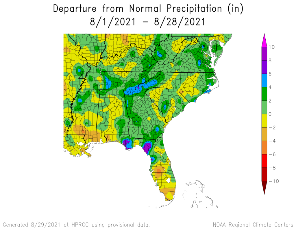
It’s almost the end of August 2021, so let’s take a quick look at the month to date. The maps from the High Plains Regional Climate Center show that most of the region was warmer than normal this month, with the lowest departures from normal in Alabama and Georgia. The next few days should be fairly close to normal overall, so I don’t expect this to change much. Precipitation across the region was wetter than normal in most places, although there was some variability. We know that there will be some rain in the next few days associated with Hurricane Ida, so these values are likely to go up, especially in western and northern Alabama, northern Georgia, and the Southern Appalachians by the end of the month. That extra rain is likely to be welcome in Alabama, where it has been relatively dry, but not so welcome in northern Georgia, where precipitation is already quite a bit above normal due to Fred and other rain events.