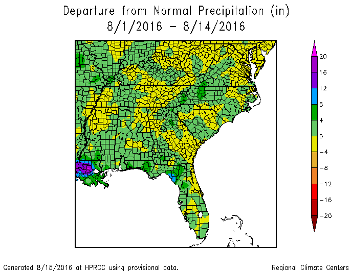
Since it is halfway through August, I thought I would take a quick glance at the climate conditions for the month so far. Precipitation values across the region range from somewhat above normal to below normal, depending on location. You can just see the heavy rain in Louisiana on the far left side of the precipitation map. Temperatures in most parts of the Southeast are above normal, with the exception of parts of Florida and southwest Georgia.
One thing the map does not show is that even though the temperatures are not record-setting, the number of stations with sustained runs of maximum temperatures at or above 90 F is quite large, as is the number of stations with minimum temperatures at or above 70 F. Athens GA has already broken their all-time string of max temperatures at or above 90 F and is expected to continue the string for a few more days before things finally cool off. Savannah is also near its all-time string of both max and min temperature runs and should break both within the next few days.