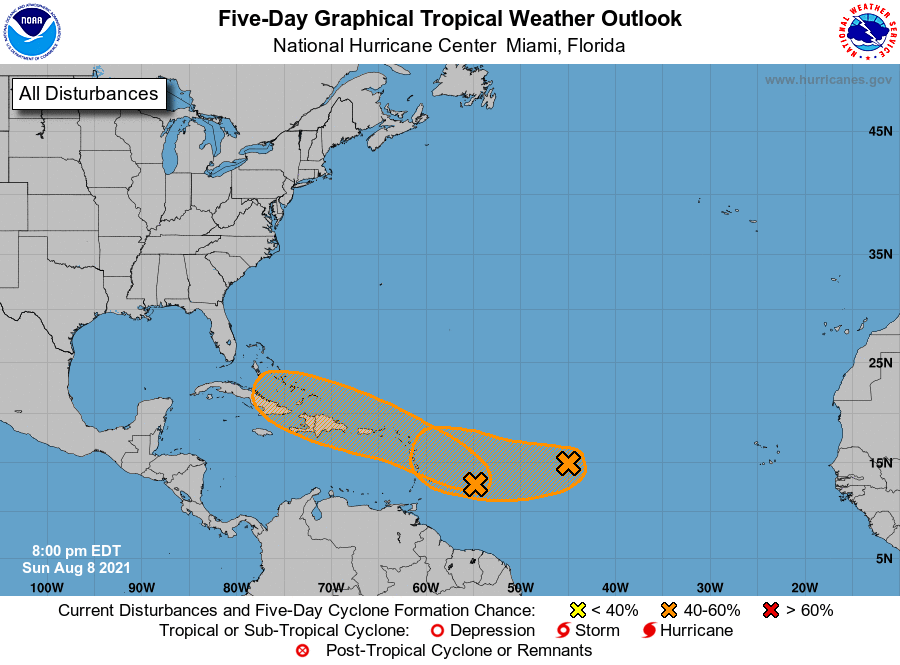
The latest 5-day tropical outlook for the Atlantic tonight shows two areas of interest. The closer one may track over or near Puerto Rico, Hispaniola, and Cuba before approaching the US mainland, most likely as a weak storm. The farther one is less organized and who knows where it will go. There is also another healthy-looking wave moving off of Africa that may cause problems down the road. None of these storms will affect us here in the Southeast any time soon (if at all), but they show that as expected, the tropics are waking up again after early activity. Keep your eyes out and finish what preparations you can before we really get into the thick of it!