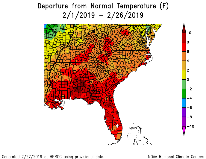
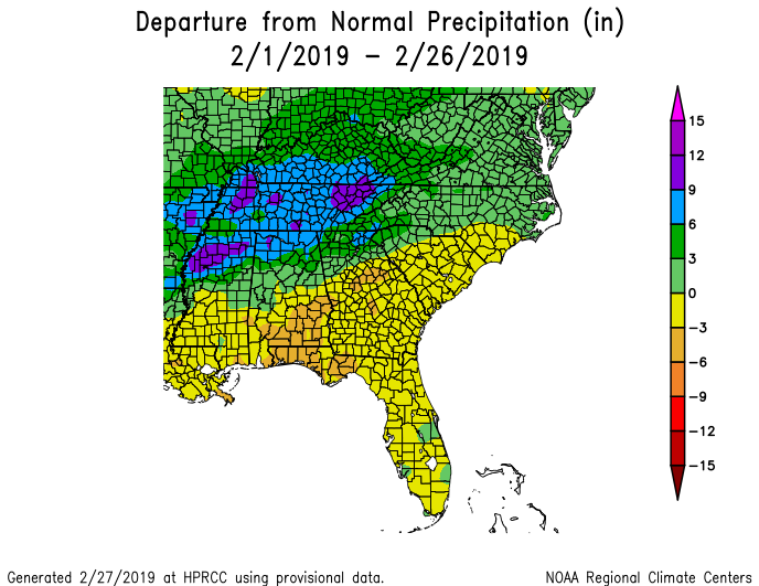
With just a couple of days to go, the temperature departures for this month are showing that we just experienced another warmer than normal February. The result of the warm weather is that plants are once again blooming ahead of schedule, potentially setting us up for another bad March if the cold air that is predicted to sweep down into the Southeast brings freezing conditions to the region. While the coldest air is currently predicted to come to the region around March 6-8, the models have been swinging around and later predictions may show that the threat of frost is easing. Still something to keep watching, especially if you are concerned about having to irrigate for frost protection. Precipitation in the region was a mixed bag, with very wet conditions in the north and drier than normal conditions elsewhere.