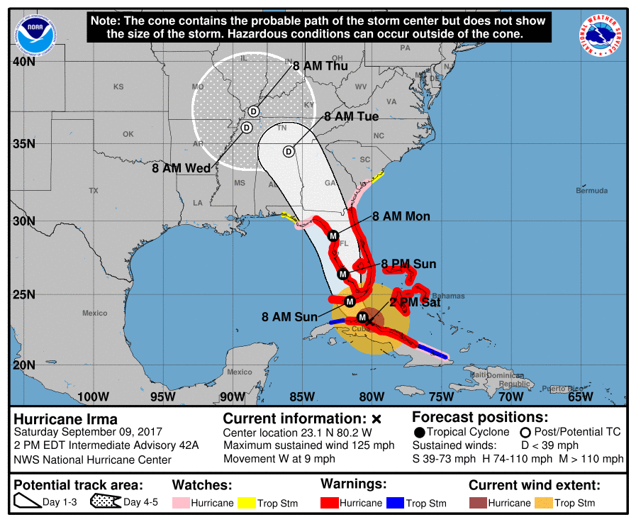
While the storm track has drifted a little bit west of yesterday’s track, the impacts on the Southeast have not really changed, except that in the eastern sections the impacts are likely to be a little weaker and in the west, a little stronger. James Spann is one of the most trusted meteorologists in the Southeast and provides a discussion of the current status of Irma at https://www.alabamawx.com/?p=144370. While his discussion is focused on Alabama, it provides information for Georgia and Florida as well. Do not take this storm lightly. Impacts will occur outside of the cone that predicts the center of the storm.
The Capital Weather Gang of the Washington Post also has an excellent the storm and its impacts at https://www.washingtonpost.com/news/capital-weather-gang/wp/2017/09/09/dangerous-hurricane-irma-bears-down-on-florida-its-brunt-targeting-the-keys-to-tampa/?deferJs=true&outputType=default-article&sdfgdfgdfgdfgdf&utm_term=.031149475710.