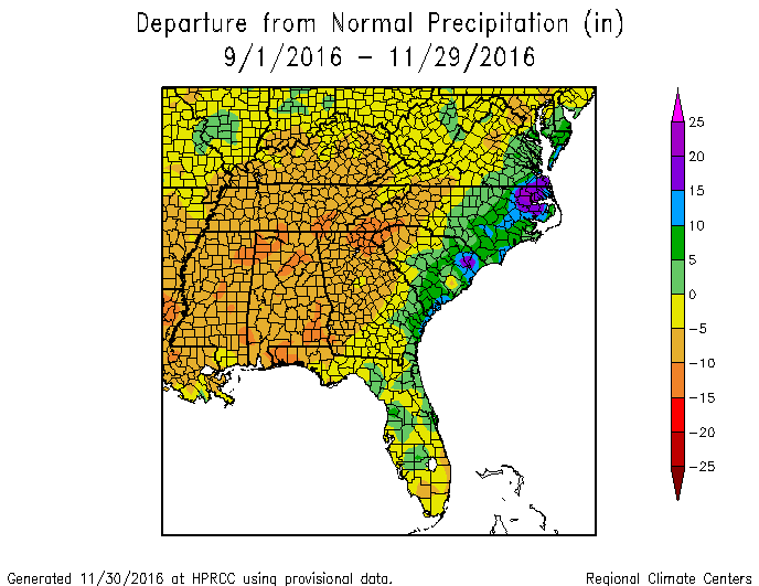
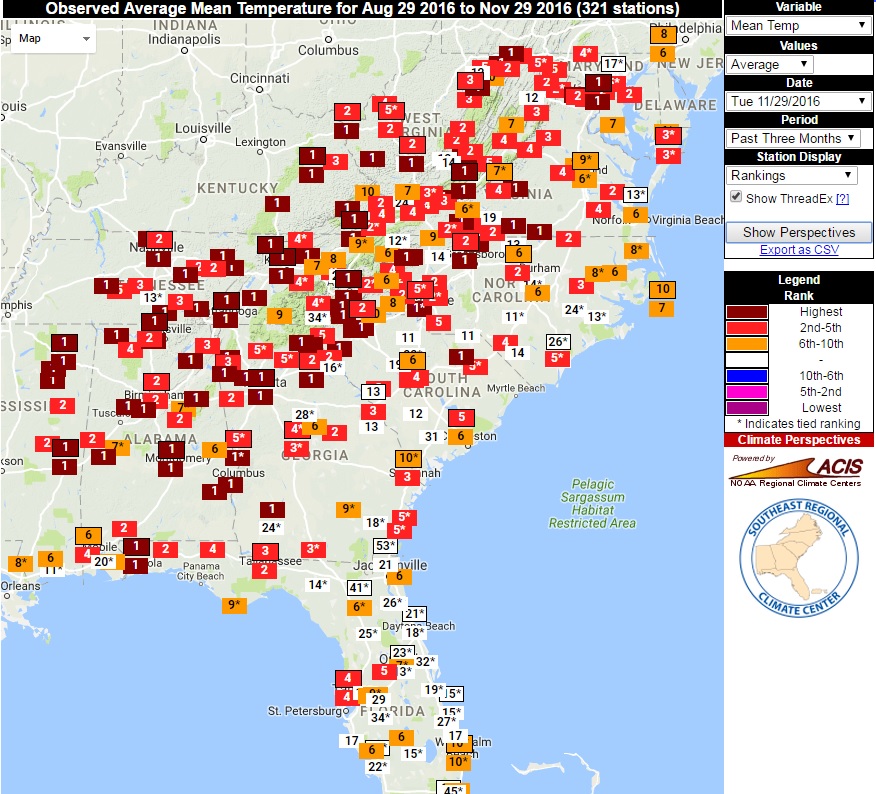
For those of us in weather and climate, today is the last day of fall. While the final statistics are not in yet (we still have today to get through), here’s a peek at the fall climate statistics. The precipitation map, as expected shows the split between the wet coastal areas hit by Hermine, Julia and Matthew and the rest of the Southeast, which was much drier than average. No wonder the drought has been expanding over the season! The temperature ranking map from the Southeast Regional Climate Center Perspectives tool shows that for many stations in the Southeast, this will be their warmest fall on record. Even for the stations with the longest records, it is in the top five warmest. It will be interesting to see where the statewide averages end up.