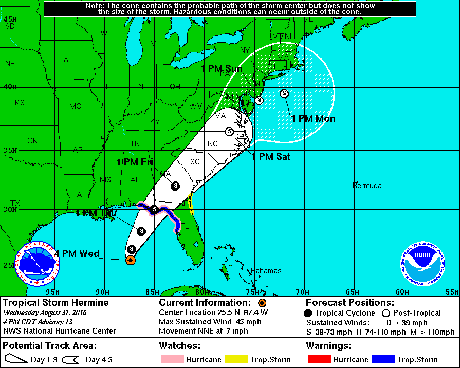
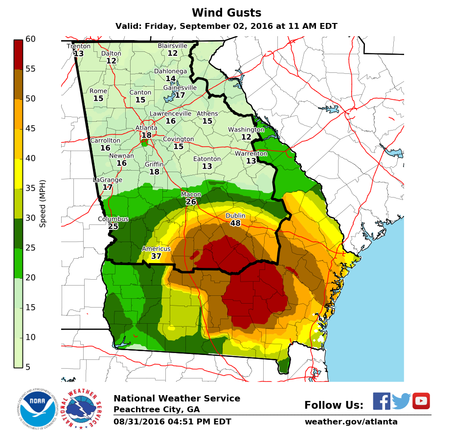
The 5 pm forecast from the National Hurricane Center shows a significant shift of the forecast cone to the west from earlier in the day. It puts the center of the track just southeast of Macon at 1 pm on Friday. The cone itself covers the southeastern 2/3 of Georgia, so anyone driving through that part of the state is likely to see strong winds and heavy rain. This could cause problems with downed trees and power lines, since wet soil is less likely to anchor trees in high winds. Tornadoes are also more likely, especially to the northeast of the center of Hermine. The track has been moving westward with time so updates later tonight could move it farther west. I would advise anyone in Georgia to pay close attention to this storm since the path is still changing. I will put out further updates later tonight.