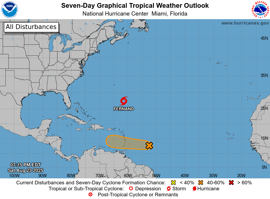
During the day today, Tropical Storm Fernand formed in southeast of Bermuda east of the path that Hurricane Erin took earlier this week. It is expected to move straight north and pass east of Bermuda so will not be any threat to the United States. Another area of interest, Investigation 99L, is currently weakening in the eastern Atlantic and is expected to move straight west. Eventually it could move over an area that is a little more conducive to development but if it does, it should go straight west and become a rainmaker for Central America and dissipate over land without affecting us, although the rain could cause flooding where it makes landfall and inland. There is another wave about to come off of Africa into the eastern Atlantic Ocean, but from there it will take almost 2 weeks before it could get anywhere close to the Southeast, which is plenty of time to watch without worry to see if it begins to strengthen. It’s near the peak of the Atlantic tropical season so we are sure to see some more of these waves in the next few weeks.