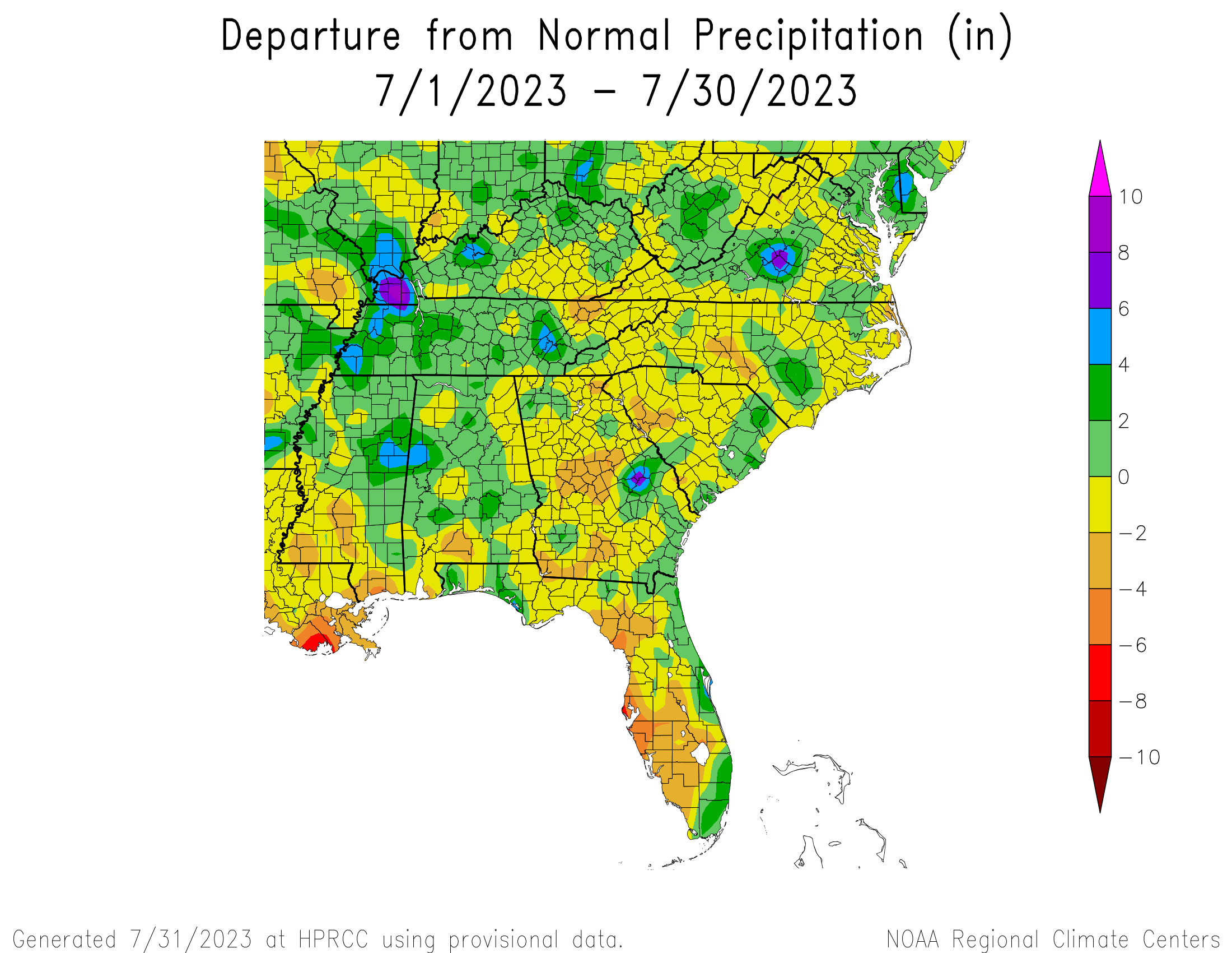
At the end of July, with just a day’s data not yet available, the maps of temperature and precipitation departures show that nearly all of the region was warmer and drier than normal, although there was some scatter as expected in summer with convective storms developing over time. The warmest part of the region was in southeast Georgia and northeast Florida as well as along the West Coast of Florida. Precipitation in Florida was drier than normal on the West Coast but wetter than normal along the East Coast. Alabama was the only state that had most of their area wetter than normal.