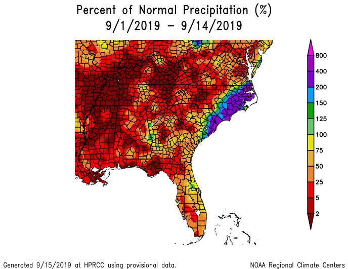
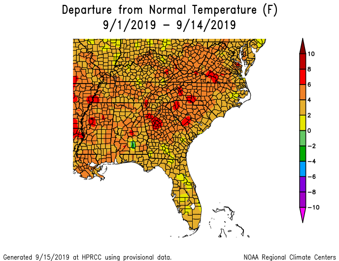
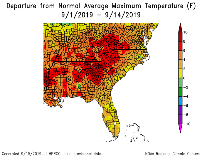
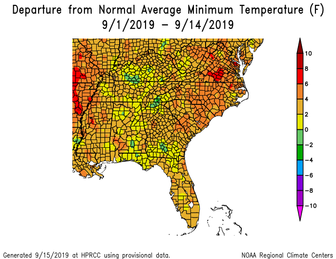
We are halfway through September, and many parts of the Southeast have received very little rain this month. The only big exception is the area hit by Hurricane Dorian. This, coupled with temperatures that are well above normal, is adding water stress to plants that are trying to make it to harvest and reducing stream and lake levels. It’s no wonder that drought levels have been getting worse. I pulled these maps from the High Plains Regional Climate Center at https://hprcc.unl.edu/maps.php?map=ACISClimateMaps.
A new feature they have is a set of maps which shows the departure of high and low temperatures separately. This month, the daytime highs are much more above average than the nighttime lows. Not surprising considering how dry it has been, since that tends to increase the daily temperature range as all of the sun’s heat goes into the atmosphere instead of into evaporating water. It is different than what we expect from long-term trends, though, since in historical trends minimum temperatures are increasing more rapidly than maximum temperatures due to a combination of increasing urbanization and humidity (plus potentially other factors which we may not have identified yet).