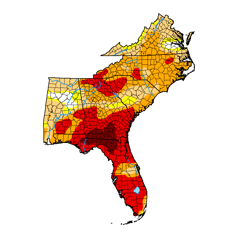
The latest Drought Monitor map, released last Thursday, shows that drought increased in large parts of the Southeast in the past week due to the lack of rain. The area of exceptional D4 drought increased to over 5% of the region. Less than 3 % of the region has no dry conditions at all. Some areas did get rain this Easter weekend and that could result in some temporary improvements in next week’s map, but the next week looks like it will be dry again so improvements are likely to be short-lived. If you want to look for previous weeks with conditions similar to this, you can use the DM map archive at https://droughtmonitor.unl.edu/Maps/MapArchive.aspx. But I warn you that you will have to go back to about March 2008 to find spring conditions that were as bad as what we are seeing now, although the driest conditions then were in NW Georgia and NE Alabama as well as North Carolina and Tennessee.