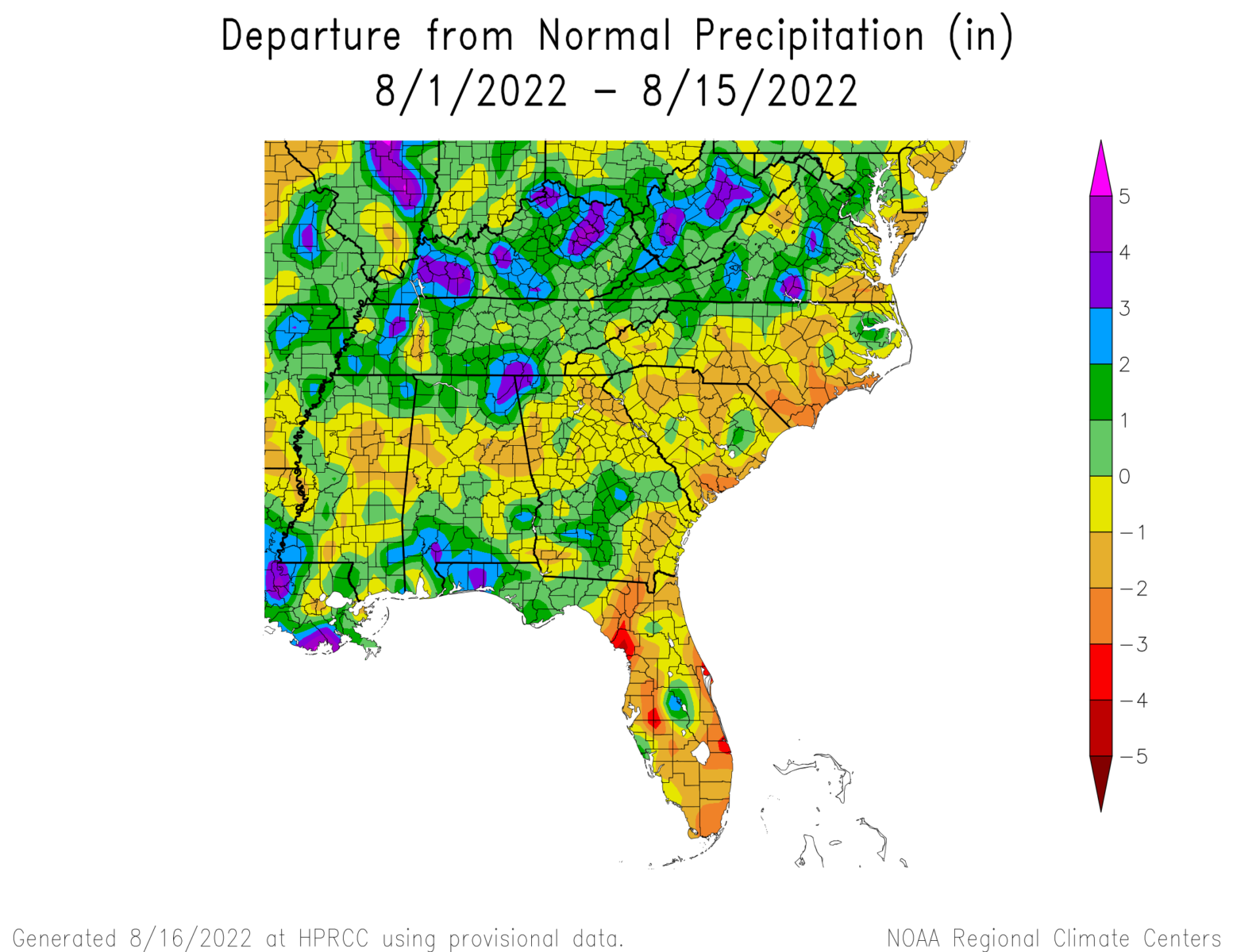
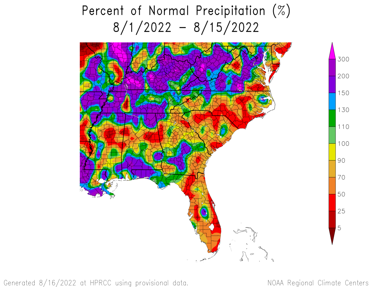
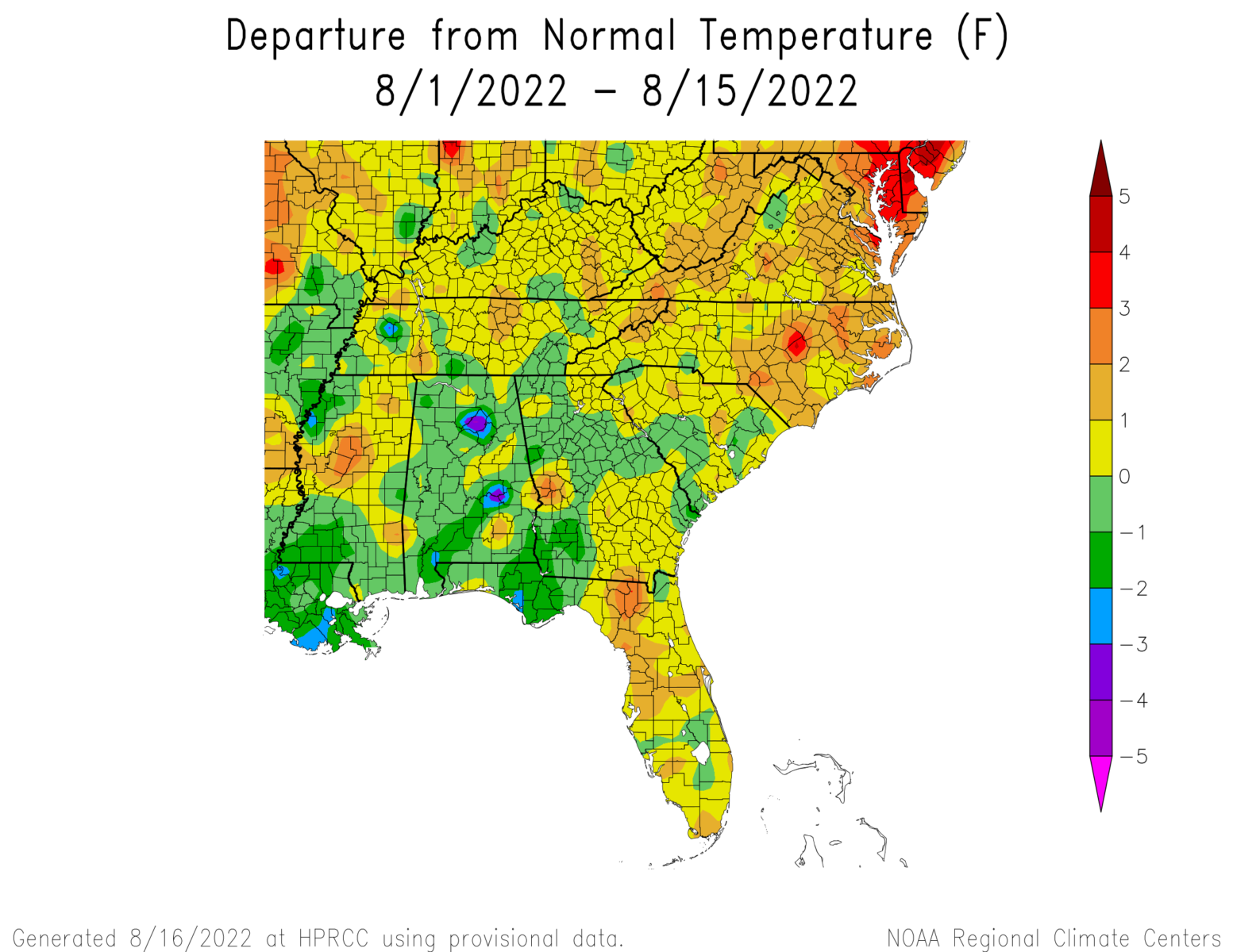
Since it is halfway through August (already!), let’s take a look at the climate of the month so far. The map of precipitation departure shows that most of the region was drier than normal, but there were areas of wet conditions. The map of precip percentages shows how little of the region had near normal rainfall, with most areas either much wetter or much drier than normal conditions. Not surprisingly, the coolest locations were generally where the most rain fell, most likely because wet soil and more clouds kept daytime heating lower. Virginia was the exception here, with temperatures well above normal in spite of the rain.