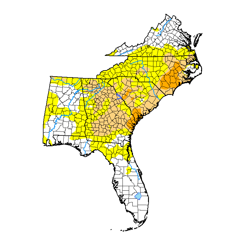
The latest Drought Monitor, released this morning, shows a big expansion in the areas of moderate (D1) and severe (D2) drought along with increases in abnormally dry conditions (D0). Even so, I think they missed some areas that should really be in drought and am working to let the authors know for next week. The combination of near-total lack of precipitation with warm temperatures has contributed to that drought increase. Our weather pattern has shifted somewhat to a pattern that allows for the development of scattered afternoon thunderstorms has improved things somewhat, but we will have to wait to see if we get much more rain out of it. Most likely some areas will be hit hard and others missed completely due to the nature of summer storms. By next weekend we may see some additional rain to parts of the Southeast, especially western areas, due to the remains of the tropical blog that is in the NW Gulf right now, but how much remains to be seen.