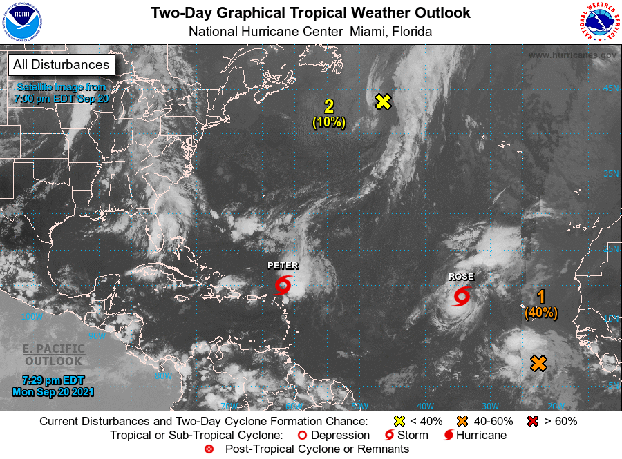
The latest glance at the tropical Atlantic shows a lot of activity, including TS Peter and TS Rose, plus a couple of areas of interest. Both Peter and Rose are expected to turn north well before they get close to the US, so neither of them is a factor in our weather. The center of interest in the north Atlantic has only a small window of time for development before it gets into unfavorable conditions. The center we are most interested in is in a wave that recently came off of the west coast of Africa and has an 80 percent chance of developing into a named storm (probably Sam, the next on the list) in five days. This storm needs to cross the Atlantic before it is of concern to us, and the long-range forecasts indicate it may also turn north, but we have a long time to watch it before we need to make any plans for it. Even though nothing is threatening us now, we will have almost half the season still to go, and the likelihood of a storm in October is still pretty high, so keep an eye on the skies and don’t dawdle on your field work in case something blows in. Once the cold front moves through on Wednesday, we should see dry skies and cooler, drier conditions for at least the next several days, perfect for getting outdoor work done.