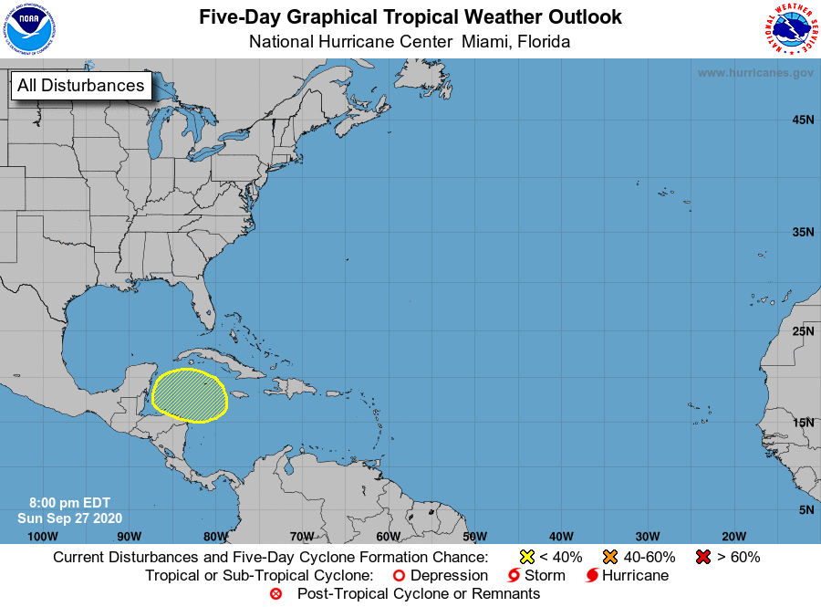
The Atlantic is quiet now, with no named storms in existence and nothing immediately threatening on the horizon. However, the 5-day outlook does show an area in the Caribbean that has a 20% chance of developing in the next five days. The models indicate that it could become a tropical storm by the end of the first week in October. Model paths are all over the place, but a landfall on the northeastern Gulf Coast or somewhere on the Florida peninsula are both possible, so it is something to watch this week. Meanwhile, the major weather event this week will be a cold frontal passage Monday night through Wednesday morning, bringing some gusty winds and rain to the region. After the front passes, the rest of the week should be cool and dry.