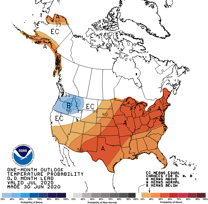
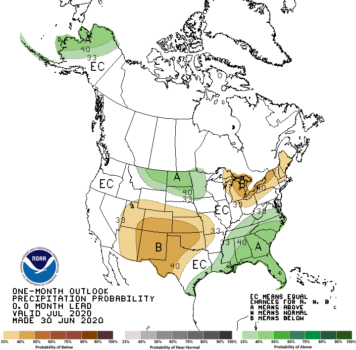
The latest outlook for July 2020 shows that warmer and wetter conditions are likely to occur for the month across most of the Southeast. The first two weeks of July are predicted to be fairly rainy, with drier conditions in the second half of the month. The outlook for July through September also shows warmer and wetter conditions are likely. The current outlook for the last quarter of 2020 shows that continued warmth is expected to continue based on long-term temperature trends, but precipitation is trending towards normal rainfall.
The current ENSO status is neutral, but the Pacific Ocean is showing signs of a developing La Nina which may occur by fall and last through the end of the year, although after that it is expected to return to neutral conditions. La Nina usually does not have much impact on fall temperatures, but often La Nina falls are drier than normal. If the La Nina continues into 2021, this dryness would be likely to continue through the winter.
After an early start to the Atlantic tropical season, dust blowing off the Sahara Desert has stabilized the atmosphere and tamped down tropical activity. The dust has mostly dissipated and the ocean is warming up now, which will add fuel to any tropical waves moving out of Africa in the next few weeks. The rest of the tropical season is expected to be quite active, although we don’t know where any storms that develop are likely to go or if they will even make landfall. However, with the very warm ocean temperatures, the storms could strengthen quickly, so producers should be watching the tropics carefully as the season progresses and be prepared to act quickly if a storm is predicted to move towards them.