Main points:
- Neutral conditions are expected to change to La Niña by fall
- Active Atlantic hurricane season, but no way to know where they will go
- Long-term trends towards higher temperatures and humidity, especially at night
- Warmer and wetter conditions likely across Southeast summer, especially near Gulf Coast, with warmer than normal temperatures continuing through fall
- Some potential for dry conditions in fall if La Niña develops
Now that we’ve passed June 1, we are in climatological summer and also in the official Atlantic Tropical Season. The early part of this year has been wet for a lot of the winter and early planting season, although we have seen some dry conditions return to the region in recent weeks. We’ve also seen some early tropical activity in the Atlantic as Tropical Storms Arthur and Bertha have formed, although they caused minimal damage, mostly from heavy rains. What can we expect for the rest of this growing season and into the fall harvest period?
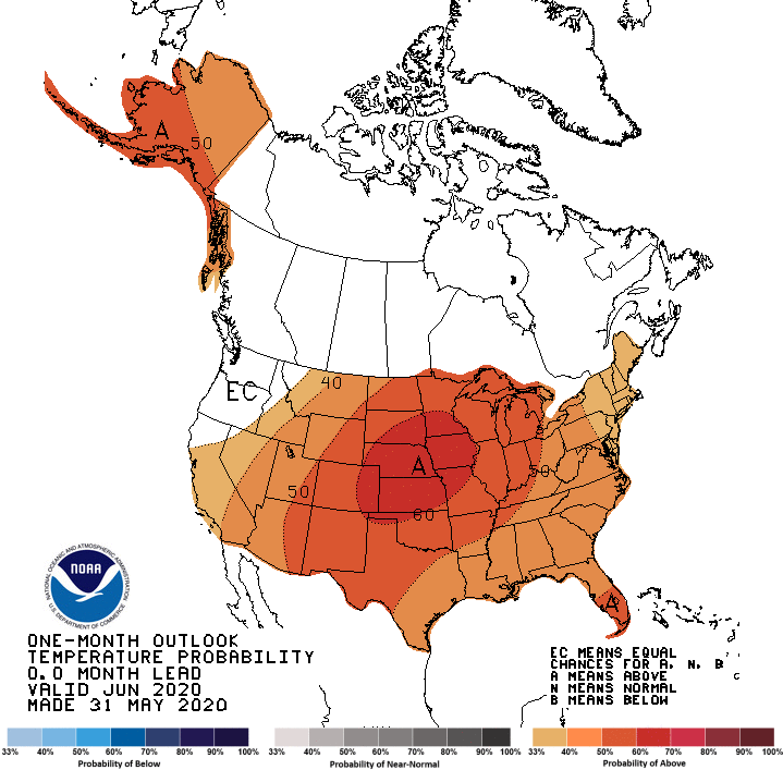
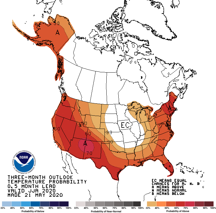
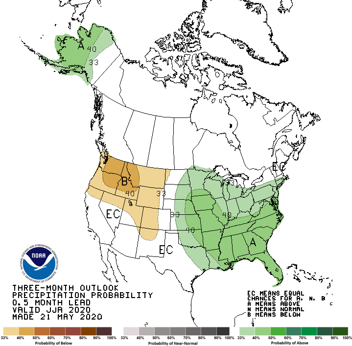
The major factors to consider for this year are the long-term climate trends and the status of El Niño/La Niña, which will affect the Atlantic tropical season. Average temperature since the 1960’s has risen across the Southeast by about 3 F; daytime high temperatures have risen by about 2 F, while nighttime minimum temperatures have increased by about 4 F. The rise in nighttime temperatures is mainly attributed to increases in humidity, with small contributions from urban heat retention. This is true for both summer and fall. Precipitation has not changed much over that time period, although there are big swings from one year to the next. Over the last few months we have been in ENSO-neutral conditions, with neither an El Niño or La Niña present, although we have been on the warm side of neutral. But in the last month we have seen a significant swing toward La Niña conditions, and I expect that by the end of summer we will be in a La Niña. La Niñas are associated with active Atlantic tropical seasons due to lack of vertical wind shear, which allows tropical waves to intensify more frequently than in El Niño seasons.
Based on those trends and the Climate Prediction Center maps, I expect that the summer is likely to be warmer than normal across the region, and wetter than normal especially along the Gulf Coast. Higher than usual humidity is likely, especially overnight. Fall is also likely to be warmer than normal but there are no clear signals in precipitation except in the Florida Peninsula, which is expected to be wetter than normal due to increased tropical activity. Predictions of the number of Atlantic named storms this year uniformly indicate that we will see more storms than usual. However, keep in mind that an active season does not necessarily bring more rain to the Southeast; 2019 was well above normal in the number of storms but there were only two that affected Georgia—Hurricane Dorian along the Atlantic Coast and TS Nestor that brought beneficial rain to a lot of the Southeast (and a little too much in some places). Since the Gulf of Mexico is quite warm that means that there is a potential for more rapid intensification of Gulf storms than usual. If a storm approaches the Southeast from the Gulf, it could continue to intensify all the way to the coast like Michael did, although many other factors also come into play. Because storms could develop quickly, you will need to watch weather forecasts carefully to see what is coming your way if you have fieldwork or harvesting planned. There is also a chance of dry conditions in fall if La Niña develops quickly, but what happens at your location will depend on where the tropical storms go this year.
I post occasional updates on my blog at https://site.extension.uga.edu/climate/ and also on Facebook at SEAgClimate and on Twitter at @SE_AgClimate, or email me at pknox@uga.edu.