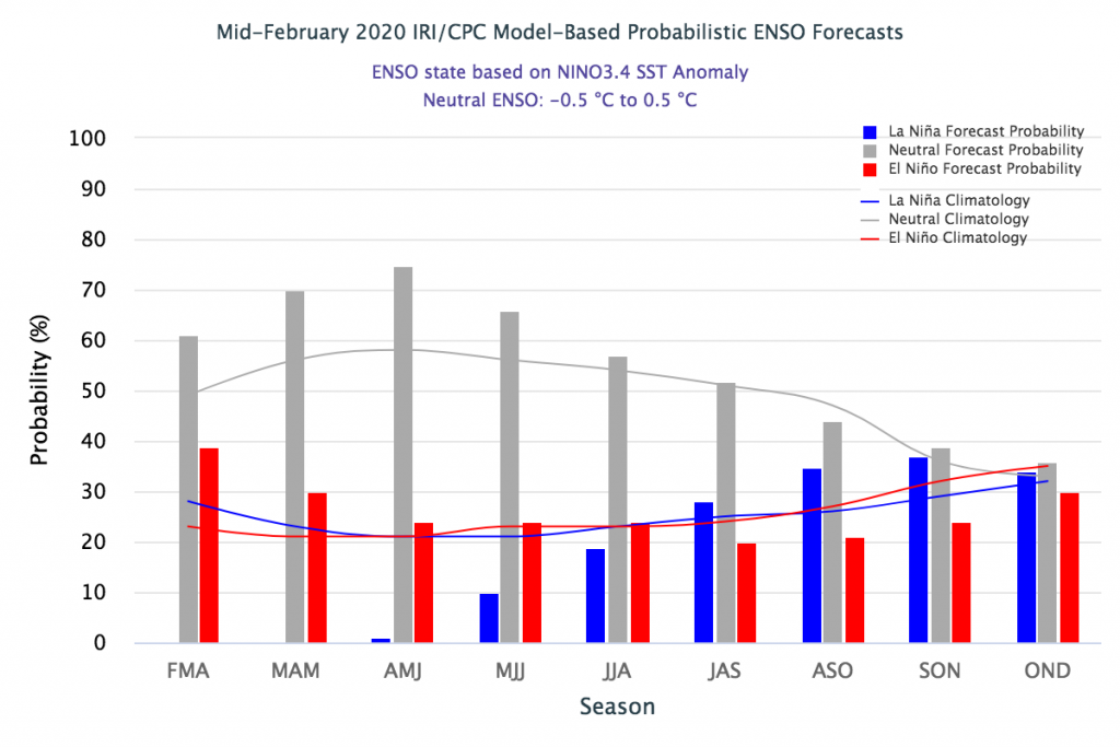
Some recent articles have suggested that after being in ENSO-neutral conditions for quite a while now (albeit on the warm side of neutral), the eastern Pacific Ocean is headed towards a cooler pattern associated with the La Niña cold phase of the Southern Oscillation. If this does occur, we can expect a more active Atlantic hurricane season this fall (although we don’t know where the storms would go or even if they would make landfall), and if it continues into winter, a warmer and drier winter than normal, which could set things up for drought conditions in parts of the Southeast in 2021. That’s a pretty big IF at this point, but something worth watching. Spring forecasts of what ENSO will do are not great because of what we call the “spring predictability barrier” so we won’t know for sure for a few months, but it is something to keep in mind. Here are a recent article for you to look at along with the forecast from Columbia University’s IRI.
Weather Underground: Will La Nina Develop and Boost the 2020 Atlantic Hurricane Season?
IRI ENSO Forecast: February 2020 Quick Look (may be overwritten if you view this after February)