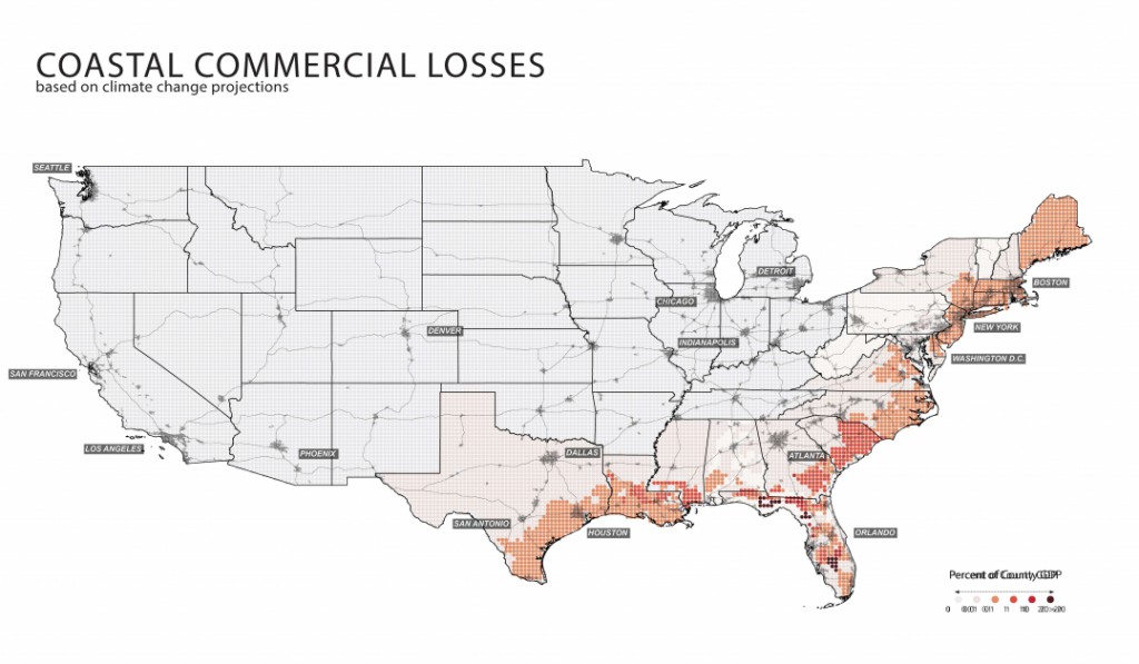
Here is a new atlas that describes a lot of factors related to agriculture, land use, and population density, among other factors, across the United States. While it was developed for use in the “Green New Deal”, even if you don’t think that is a feasible plan for dealing with changing climate, you will still be intrigued by the maps of where different crops are grown, where people live, where infrastructure is located, and what types of land use are scattered around the country. The atlas also provides maps of how those are likely to change over time as the earth warms up and what some of the economic losses would be. You can read more about it at Curbed.com here or go right to the atlas at https://mcharg.upenn.edu/2100-project-atlas-green-new-deal.