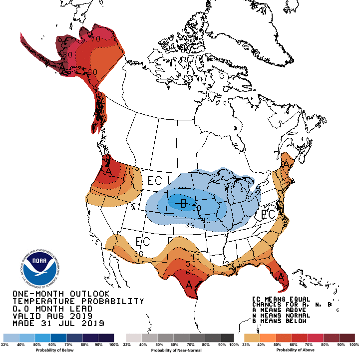
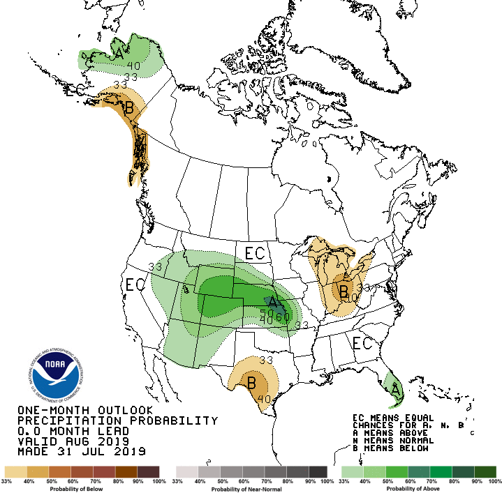
The latest outlook for August 2019 was released today by NOAA’s Climate Prediction Center, and they show that for the next month the region leans towards warmer than normal conditions. Precipitation is listed as having equal chances of above, below or near normal, but if you look at the breakdown by weeks at https://www.cpc.ncep.noaa.gov, most weeks are leaning towards drier than normal conditions. The uncertainty comes in part because we are entering the prime tropical season, and climate models don’t handle small events like tropical storms well. Right now there is a disorganized area at the south end of the Florida peninsula which is not expected to become a tropical storm but which will bring rain to that part of the Southeast before it moves northeast out to sea. A second tropical wave is now moving westward in the Atlantic, but it is a long ways out and there is plenty of time to see if it becomes a rainmaker for the Southeast.
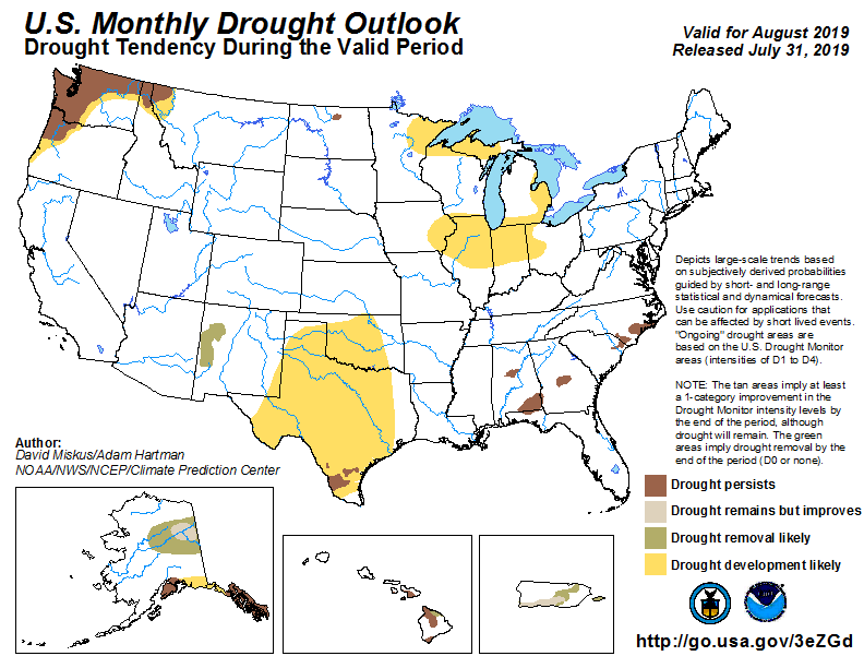
Because of the increased chance of warm temperatures as well as the lack of signal on rainfall, CPC indicates that the areas of drought that are present in the Southeast are not likely to go away any time soon.