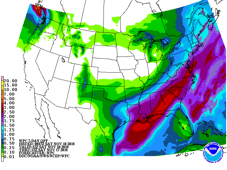
The latest 7 day QPF map shows that after a cool and dry weekend, rain will return to most of the Southeast by Monday evening as a Gulf low forms near Louisiana and races to the northeast, bringing up to several inches of rain over parts of the region by Wednesday. The only part of the region that will stay nearly dry is the Florida peninsula, which will be missed by the storm. After the storm moves out, high pressure will return to the area, bringing cooler temperatures and some frost to most of Alabama and areas north of the Fall Line in Georgia, South and North Carolina and southern Virginia.