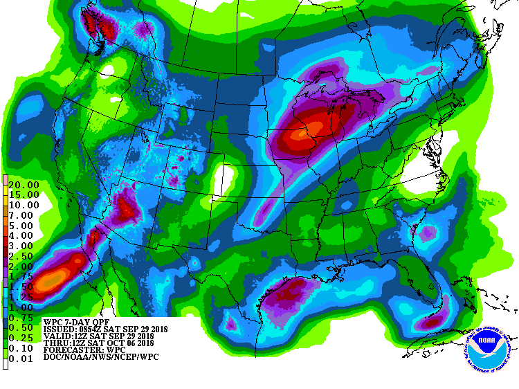
The latest 7-day QPF map shows that rain this week is mainly associated with a slow-moving weak cold front which is now draped through southern Alabama and Georgia. It is expected to move farther south over the next few days. Most of the rain this week will occur near the front, and once it moves into Florida by Tuesday the rest of the region should be dry, while rain increases in the Florida peninsula. Rain amounts should be less than an inch almost everywhere and parts of North Carolina and Virginia are not expected to get any rain at all. Temperatures are expected to continue to be above normal for the next few weeks and wetter conditions are likely to return later in October, although fall is usually a dry time of year.