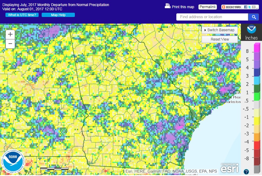
After a month of below normal temperatures, the state has rebounded to mostly a little above normal conditions. Most of the state was also drier than normal with the exception of the southeastern counties, which were well above normal due to several rain events in the region.
In Atlanta, the monthly average temperature was 81.2 degrees F (1.0 degrees above normal), in Athens 80.9 degrees (0.3 degrees above normal), Columbus 83.6 (1.1 degrees above normal), Macon 82.2 (0.4 above normal), Savannah 83.3 (0.7 above normal), Brunswick 83.7 (0.9 above normal), Alma 83.0 (0.7 above normal), Augusta 83.6 (2.0 above normal), Albany 83.1 (0.7 above normal), Rome 80.7 (1.1 above normal), and Valdosta 81.6 (0.1 degrees above normal).

Only one temperature record was set in July. Brunswick reported a high minimum temperature of 80 F on July 6, breaking the old record of 79 F set in 2013. Several other high minimum temperatures were tied at Alma and Brunswick during the month.
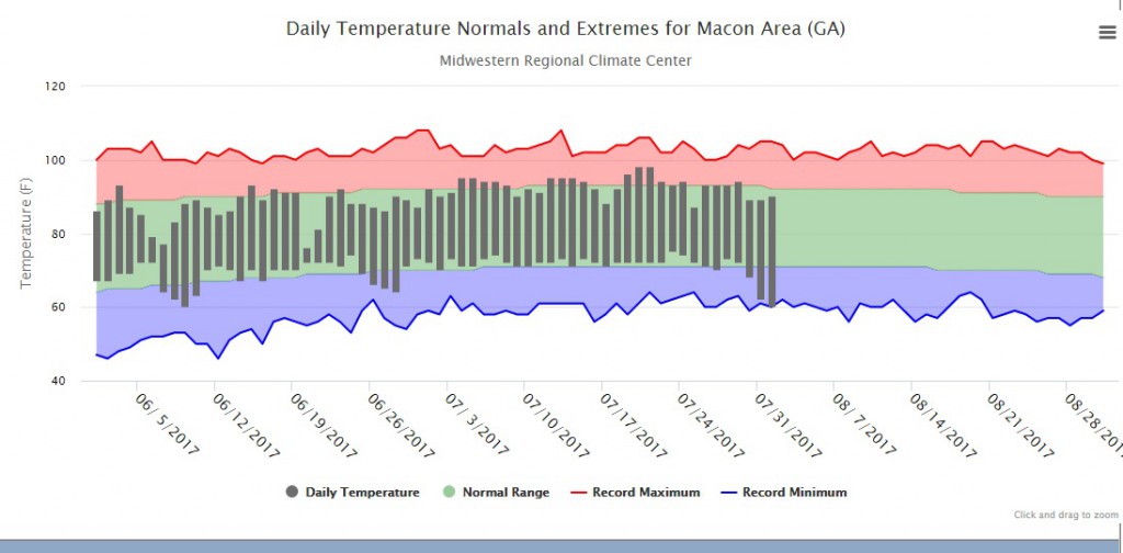
The thermograph for Macon shown above provides a good picture of how close to normal temperatures have been since June 1 for the state. Most days are very close to their normal values, with only a few cool outbreaks dropping overnight temperatures to below-normal values. Even so, most of the nighttime lows are slightly above normal, which helped contribute to the monthly temperatures being a little above average.
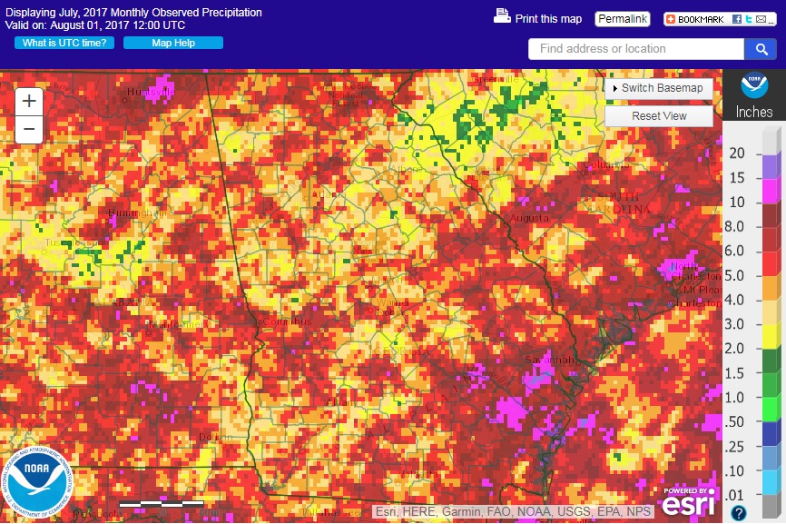
The highest monthly total precipitation from National Weather Service reporting stations was 6.58 inches in Brunswick (2.50 inches above normal) and the lowest was in Atlanta with 2.68 (2.59 inches below normal). Athens received 3.08 inches (1.39 inches below normal), Columbus received 4.98 inches (0.22 above normal), Macon 3.64 inches (1.31 below normal), Rome 2.94 inches (1.38 below normal), Savannah 6.21 inches (0.61 above normal), Augusta 5.04 inches (0.71 above normal), Alma 5.46 inches (0.13 above normal), Albany 4.16 inches (1.30 below normal), and Valdosta 3.28 inches (3.35 inches below normal).
There were no daily or monthly rainfall records set in July 2017 across the state.
The highest daily rainfall total from CoCoRaHS observers was 5.20 inches near Fort Valley in Peach County on July 25, followed by 5.06 inches measured near Townsend in McIntosh County on July 27. For the entire month, the highest total was 13.90 inches measured near Screven in Wayne County followed by 13.48 inches from an observer in Pooler in Chatham County.
Wind damage from strong thunderstorms was reported on 23 out of 31 days in the month along with some hail on July 7. Many of those storms pushed over trees, causing damage to buildings and power lines, including a 150-year-old Southern Red Oak on the campus of Piedmont Athens Regional Medical Center, which suffered a large vertical split following a series of severe storms on Independence Day weekend and had to be removed.
Even though rainfall was below normal in many places, it was enough to eliminate the last bit of drought in White County and by the end of the month, there were no abnormally dry conditions anywhere in the state. No redevelopment of drought is expected in at least the next three months.
The frequent rain showers have caused problems for farmers harvesting wheat and hay and prevented others from spraying for pests, which have become quite a problem this year. In some areas there has been too much rain and it is hard to get into the fields, while in other areas irrigation has been needed. Winds early in the month caused lodging of tobacco plants, resulting in extra labor for farmers to straighten the plants. Overall, though, crop conditions are generally good and farmers report that yields look like they will be high.
The outlook for August shows that we have an equal chance for near, above or below normal temperatures across the state. The current weather pattern makes it appear that cooler conditions will prevail in the first half of the month before a return to warmer conditions may occur. Wetter than normal conditions have a slightly increased chance of occurrence across the state through the month. The tropics are starting to enter their most active period and any storms that develop may affect rainfall in the rest of the growing season.
For more information please see the “Climate and Agriculture” blog at https://site.extension.uga.edu/climate/ or visit our web page at https://www.gaclimate.org. We are now also on Facebook at SEAgClimate and on Twitter at @SE_AgClimate. Please feel free to email your weather and climate impacts on agriculture to share on the blog to pknox@uga.edu.