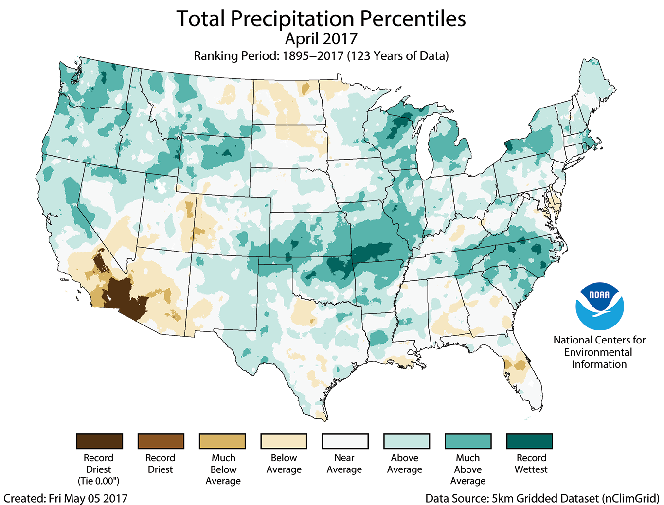
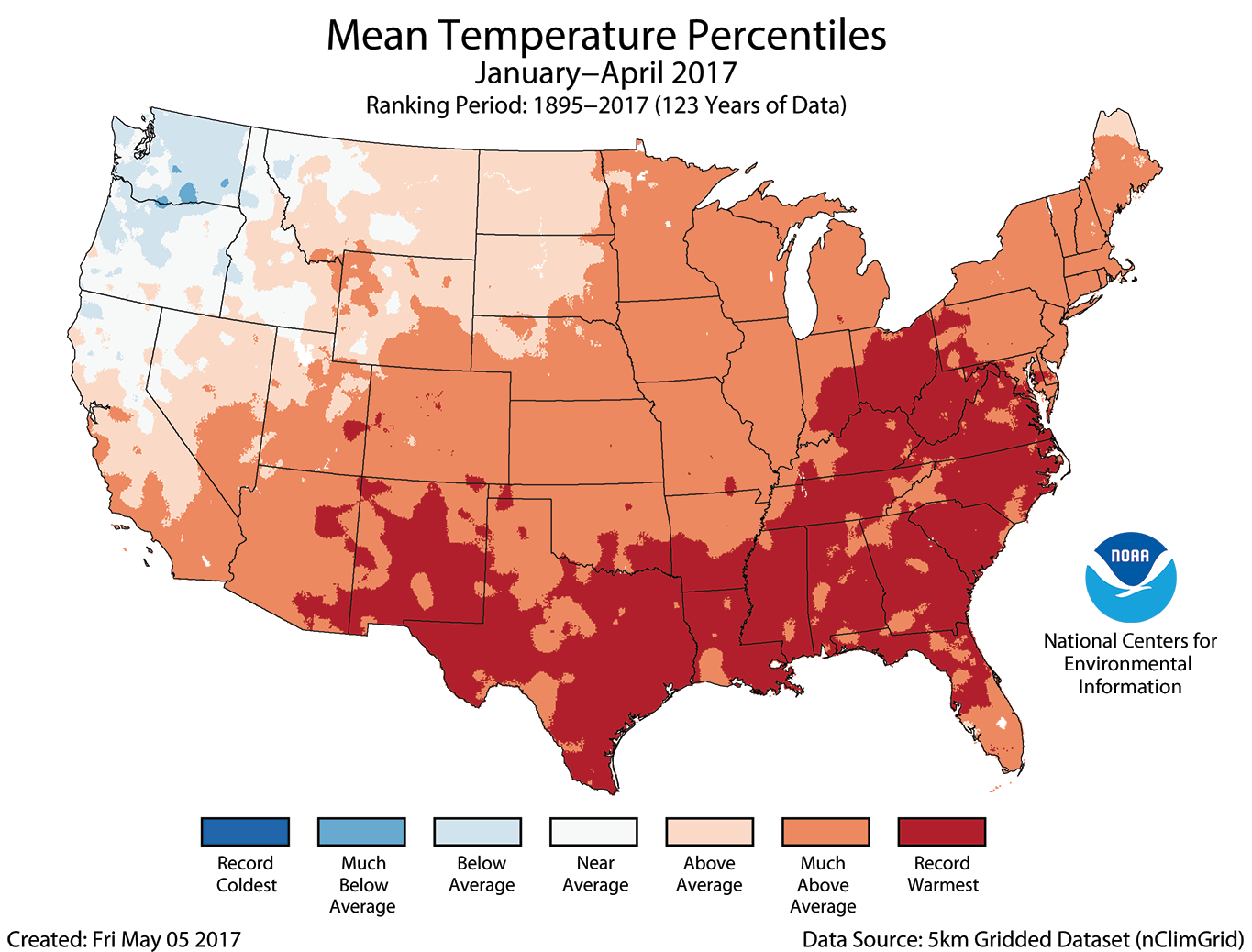
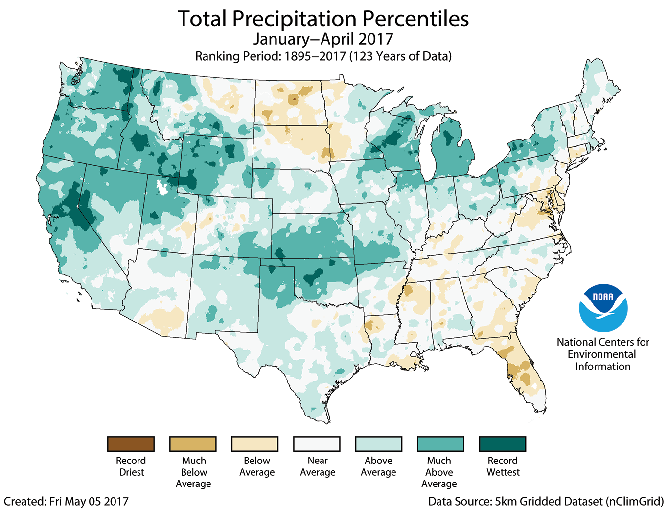
The National Centers for Environmental Information released the climate maps for April 2017 today. They show that for most of the East coast, temperatures were well above normal and many areas were the warmest on record. This helped contribute to the year-to-date maps, which show a large swath of the South and East with its record warmest year through the end of April. Precipitation in April was well above average in North Carolina and adjacent areas but is near normal for the year to date. You can view maps at https://www.ncdc.noaa.gov/sotc/national/201704 and read the written report at https://www.ncei.noaa.gov/news/national-climate-201704.