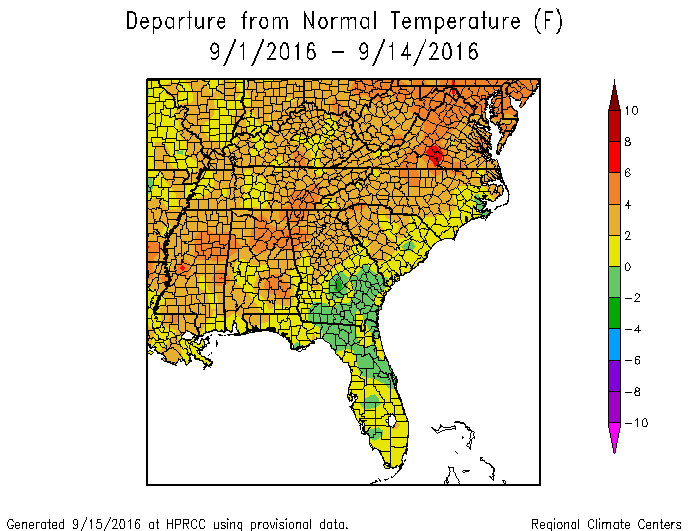
As you saw in my drought post earlier today, dry conditions and drought have expanded in many parts of the Southeast except those that have seen tropical activity. The maps for the month to date show the story. A band of heavy rain associate with Hermine and, to a lesser extent, Julia crosses northern and western Florida, southeastern Georgia, most of South Carolina and eastern North Carolina, while other parts are well below normal in rainfall. Coupled with above normal temperatures in areas not covered by wet soil and clouds from the tropical storms, it’s not surprising that dry conditions would have expanded where they did. Warmer and drier conditions than normal are expected to continue for at least the next two weeks unless the blob of convection in the Gulf of Mexico develops into something more organized, but the National Hurricane Center gives that only a 10 percent chance of happening.