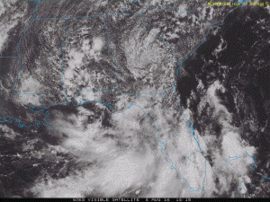
The College of DuPage web site has updated satellite images which show the slowly spinning low pressure that is bringing rain to parts of the Southeast. I’ve put one from the afternoon of August 8 below. It shows the low slowly meandering across Georgia. You can also see it in the radar picture, which I’ve attached. Heavier rains lie to the south near Florida, as expected. You can updated images at https://weather.cod.edu/satrad/.
The radar image below is a screenshot capture from https://radar.weather.gov/ridge/Conus/southeast_loop.php. You can see a bit of the swirl around the low in the radar image but it is even clearer if you run the satellite or radar as a loop instead of a still picture.

