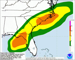
Apologies to those readers who are not in the Southeast–one last blog post on TS Hermine. The 11 pm outlook for Hermine shows that the storm has strengthened somewhat over the evening and is now expected to come ashore as a hurricane. The path has shifted ever so slightly to the east due to the latest position fix from the hurricane hunters but the cone still covers southeastern Georgia. Everyone along or near the forecast cone should have preparations completed soon.
I do not plan to post again on the storm until after it has passed and assessment of damage to agriculture has begun. Please continue to get updates from the National Hurricane Center for path and intensity information and from your local National Weather Service office for local conditions. Be smart and be safe!
