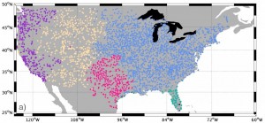
A new scientific study of long-range statistical climate forecasts (published recently in Nature Geoscience) shows that temperature patterns in the central Pacific Ocean can predict the likelihood of droughts and heat waves on the East Coast by up to several weeks. You can read a story about the research at PBS at https://www.pbs.org/newshour/rundown/pacific-hot-water-predicts-heat-waves-drought/. The Christian Science Monitor also has an article here.
Here is an excerpt from the PBS story, describing where the ocean temperatures are observed: “This pattern (the “Pacific Extreme Pattern”) encompasses a gigantic patch of water that extends laterally from West Coast to China. Its northeast corner falls near the coast of Washington, while its northwest corner tucks into the sea of Okhotsk near Japan. The Pacific Extreme Pattern’s lower border runs near the same latitude as Guatemala. That’s in contrast to El Niño, which only involves tropical water.”
This is exciting news for climatologists because it shows skill in long-range prediction from an area other than that associated with El Niño and La Niña. Knowledge about a coming heat spell a month or more in advance gives cities and agricultural producers time to prepare for droughts, water shortages, and heat stress which can be a threat to human and animal health.
