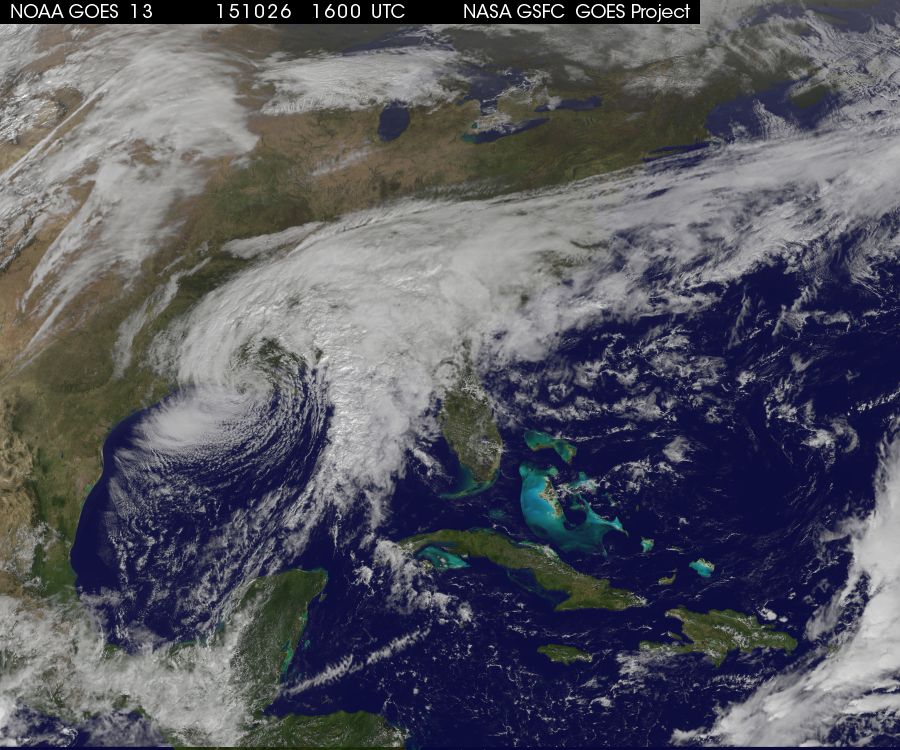
The satellite and streamline maps today show a newly developed coastal low pressure center (which spun up from the remnant circulation of former Major Hurricane Patricia) as it moves east across the Southeast today. You can see the dynamic version of the streamflow analysis at https://earth.nullschool.net/. The swirl of winds ahead of the storm’s center is pulling a lot of warm, moist air from the Gulf of Mexico over the Southeast. That, as well as some moisture from the dissipated hurricane, is leading to rainy conditions across the region through Wednesday.