As of 10 pm, the National Hurricane Center has declared there is enough of a circulation in the Gulf of Mexico to declare it a tropical storm named Bill. As predicted, Bill is headed for Texas where the ground is already sodden from persistent rain in the last few weeks. This means that flooding is highly likely and may reach new record-setting levels on some rivers.
You can get updates on the storm at https://www.nhc.noaa.gov. Trees may be susceptible to falling over even in the marginal winds because of loss of root support in the saturated soils, especially in areas where there is significant water flow adding force to the trunks. Erosion and drowning of crops is also likely, and livestock producers will need to make sure their animals are on higher ground with ample feed supplies in case they are stranded for several days. Power outages may also become widespread due to tree damage along with the winds.
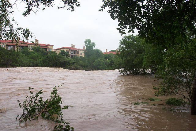
It is interesting to note that this path is similar to the one taken by Tropical Storm Erin back in August 2007. This storm also moved over saturated land where tremendous flooding had taken place in the weeks before the storm hit. The photo on the bottom shows the flooding conditions in Georgetown TX in late July two weeks before Erin hit. As it moved over Oklahoma, Erin reintensified due to the warm, wet surface conditions and almost became a hurricane again. The strong winds and rain from that system caused at least 16 casualties as well as tremendous damage to the southern Plains.