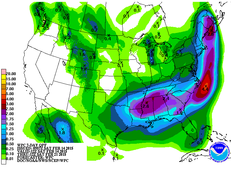
This should be a big week for wet weather in a lot of the Southeast, with the exception of south Florida. Saturday will be the nicest day in the week for most of the area, and then things get interesting with the next blast of cold air moving into the region on Saturday night into Sunday.
A winter storm is expected starting in the west and north on Sunday night and moving through the Southeast Monday and Tuesday. Southern areas are likely to get a cold rain, but northern areas could see sleet, snow, rain or freezing rain depending on location, elevation, and the specifics of the evolving storm track. You will definitely want to keep a close eye on the forecasts for this one! Now might be a good time to download the new National Weather Service widget for forecasts specific to your area at https://innovation.srh.noaa.gov/NWSwidget/. After this storm moves out on Tuesday we should see a day or two of respite before the next storm moves into the region late in the week.