As expected, the frigid air has arrived in the Southeast, and near-record setting temperatures were experienced across a lot of the area this morning. The map from CRONOS from the North Carolina State Climatology Office at 8 am below shows the extent of the cold air.

Today the maximum high temperature in many areas will stay below freezing and is expected to set new daily records across the area. On Friday the cold will continue and more records of minimum and maximum temperature are expected to be set at many stations before a warming trend sets in. After a winter storm affects far northern parts of the region on Friday into Saturday, temperatures are expected to warm up and we may see temperatures in the 60s by Sunday.
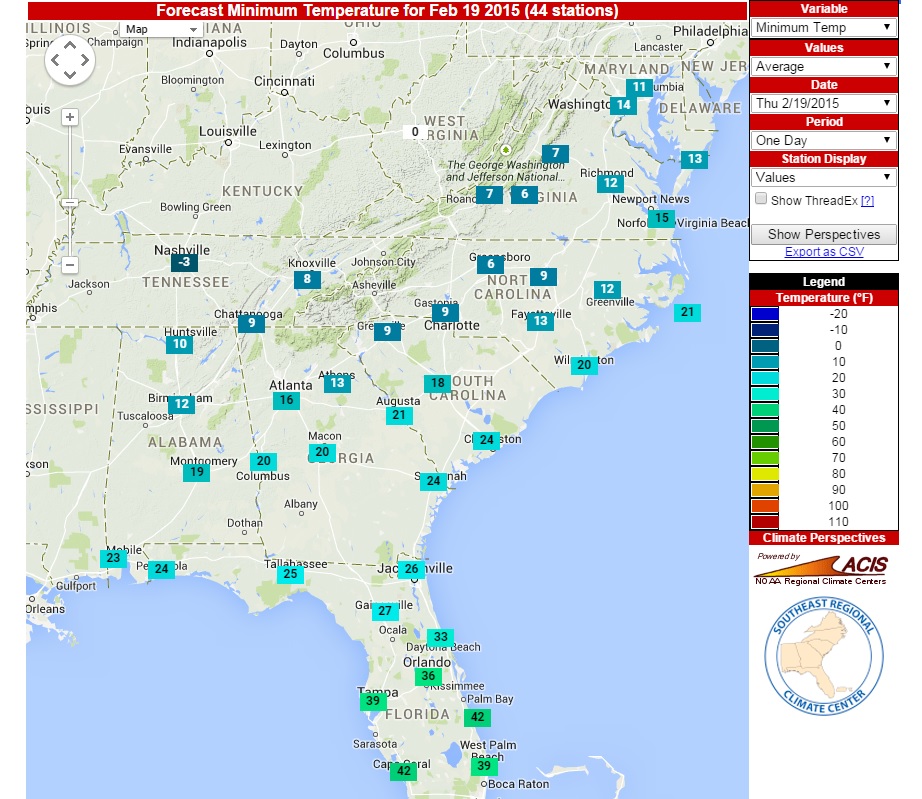
Below are the forecast lows for this morning from the SERCC perspectives tool. Pretty good forecast! You can also use this tool to look at forecasts up to three days ahead and see what the rankings of the value are compared to the historical record. Results from today’s forecast indicate that both Thursday and Friday will be record-setting cold for the dates.
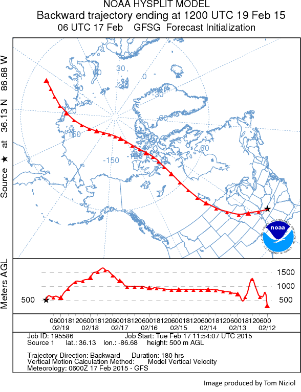
Where is this cold air coming from? Tom Niziol of the Weather Channel produced a nice streamflow analysis which shows the source of the air as coming from Siberia. No wonder it is so cold and dry!
If you have to work outside today, or even move around outdoors, it is a good idea to dress warmly and protect your skin. The National Weather Service provided this excellent guide to frostbite.
https://www.crh.noaa.gov/oax/safety/frostbite.php
If it makes you feel any better, it was -32 F in Wisconsin this morning. Stay warm!