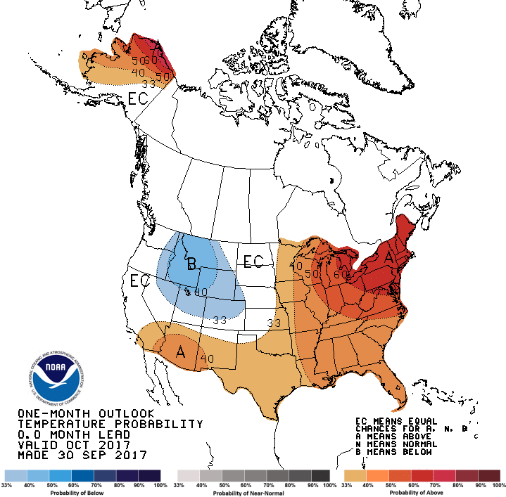
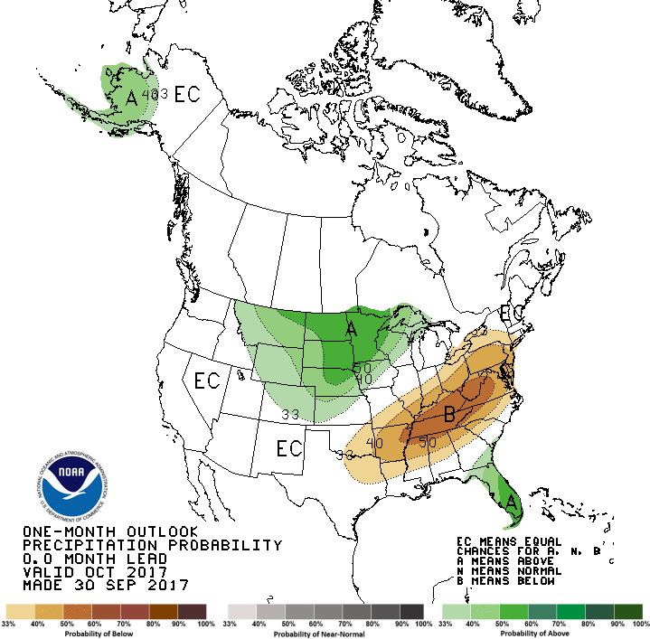
The latest outlooks for fall and winter show a pattern that is consistent with the expected La Niña event. In October the current wave pattern of a trough in the western US and a ridge of high pressure in the eastern US should continue to bring us above-normal temperatures and drier than normal conditions. This could delay the peak of fall colors by a couple of weeks and could be an issue for farmers planting small grains and winter forage.
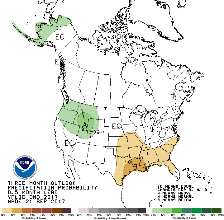
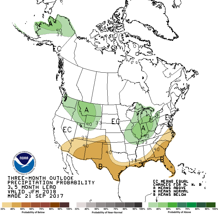
Conditions for the winter show an increased chance of above normal temperatures and below normal precipitation across the Southeast this winter, but especially in south GA and AL and south into Florida, as the jet stream which steers precipitation-producing storms north through the Ohio River Valley. This pattern is expected to abate in early to mid-spring. Dry conditions in spring and early summer could cause some problems farmers who are hoping for moisture as they start planting as well as for pollinating corn. The seasonal drought outlook shows a chance for the development of drought in Alabama and points west but does not indicate a chance of drought developing in the next three months in the rest of the Southeast. Keep in mind that La Niñas can be a factor leading to drought in the next growing season because it means less soil moisture building up over the winter months to act as a buffer during dry spells in summer.